Enid and Wednesday – inspired by The Addams Family
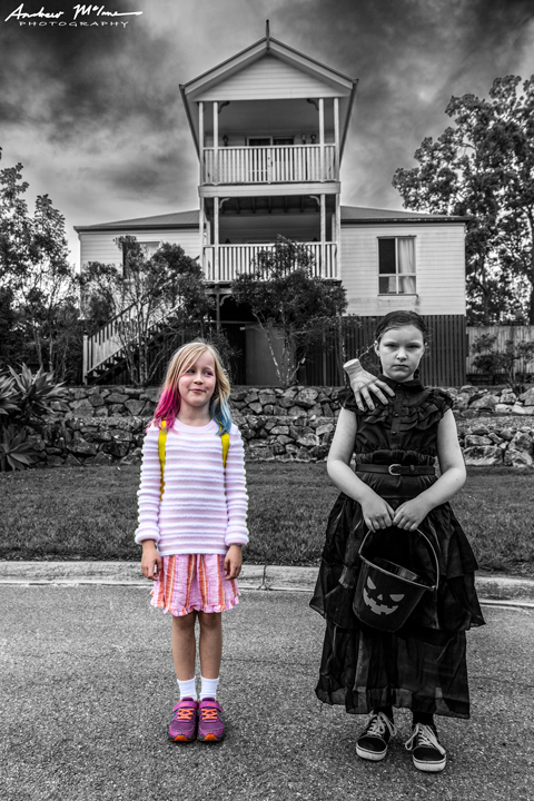
©2016 Andrew McInnes
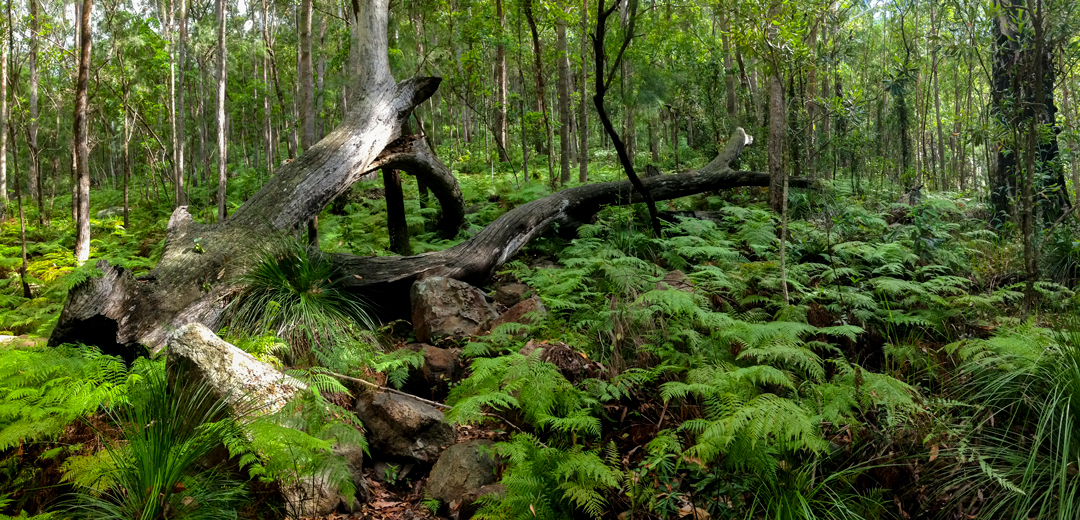
Enid and Wednesday – inspired by The Addams Family
Images along the way in Western Australia, driving east to South Australia and beyond.
This scene is between Madura – Mundrabilla, Western Australia.

Roe Plains 2AM-001790
©Andrew McInnes
Sunset somewhere along the Nullabor Plain.

Nullabor Plain 2AM-001784 ©Andrew McInnes

Eyre Highway 2AM-001768 ©Andrew McInnes

Eyre Highway 2AM-001776 ©Andrew McInnes

Eyre Highway 2AM-001777 ©Andrew McInnes

Eyre Highway 2AM-001779 ©Andrew McInnes

Nullabor Plain 2AM-000345 ©Andrew McInnes
One of our bush-camp spots.

Nullabor Plain 2AM-000353 ©Andrew McInnes

Nullabor Plain 2AM-000355 ©Andrew McInnes
Eucla – very near the edge of W.A.

Cheers 🙂
Skeins of yarn at The Yarn Bowl, Banyo, Queensland.
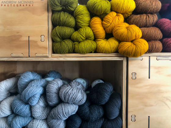
Yarn-2AM-000770 ©Andrew McInnes
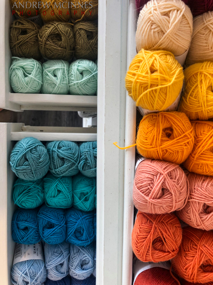
Yarn-2AM-000771 ©Andrew McInnes
Cheers 🙂
Some images of the granite Wave Rock, near Hyden, Western Australia. These three images are taken over a period of 30 minutes – two are light-paintings and one (the first image here) is with no light -painting.

Wave Rock 2AM-001749 ©Andrew McInnes

Wave Rock 2AM-001747 ©Andrew McInnes

Wave Rock 2AM-001760 ©Andrew McInnes
Cheers 🙂
Gnarabup Beach and the White Elephant Café – at Prevelly in the Margaret River Region of Western Australia.
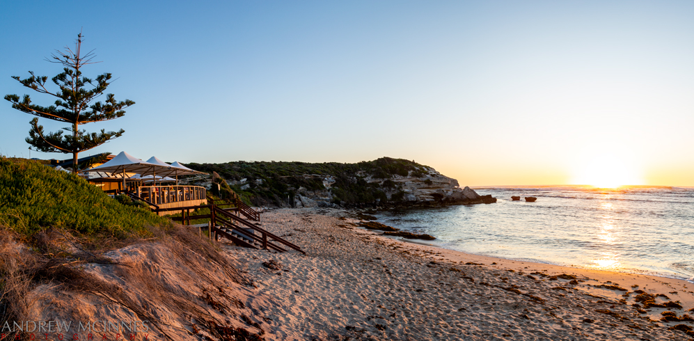
Gnarabup Beach 2AM 1508-1512 stitch ©Andrew McInnes
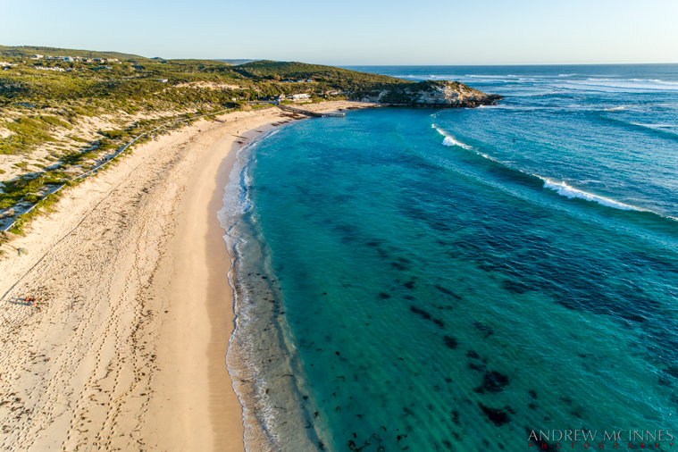
Gnarabup Beach 2AM-000249 ©Andrew McInnes
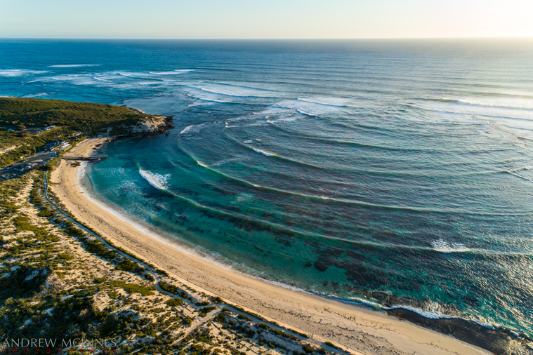
Gnarabup Beach 2AM-000252 ©Andrew McInnes
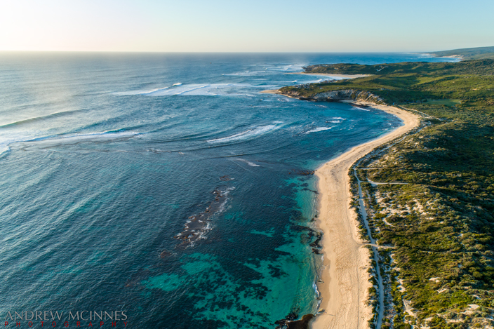
Gnarabup Beach 2AM-000254 ©Andrew McInnes

Gnarabup Beach 2AM 258-260-stack ©Andrew McInnes
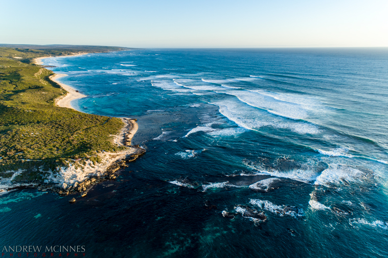
Gnarabup Beach 2AM-000261 ©Andrew McInnes
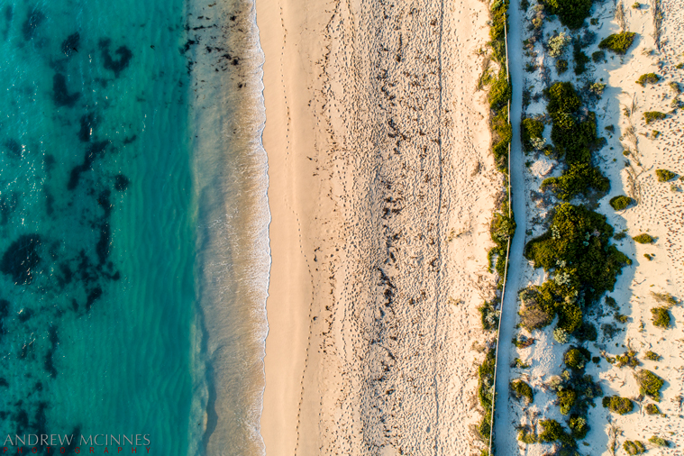
Gnarabup Beach 2AM-000264 ©Andrew McInnes
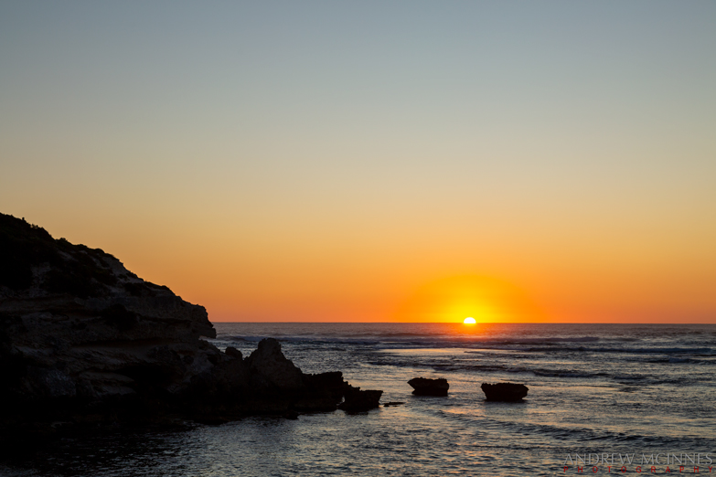
Gnarabup Beach 2AM-001530 ©Andrew McInnes
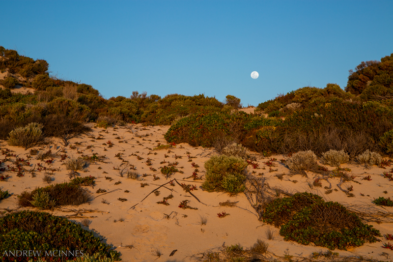
Gnarabup Beach 2AM-001497 ©Andrew McInnes
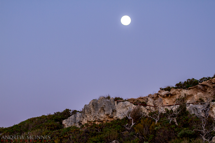
Prevelly 2AM-000086 ©Andrew McInnes
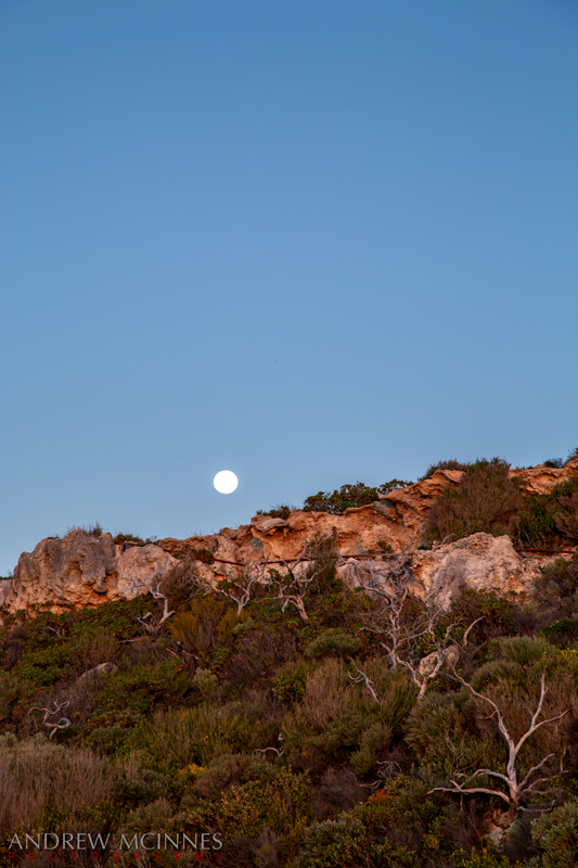
Prevelly 2AM-001525 ©Andrew McInnes
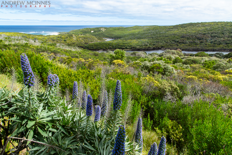
Margaret River Prevelly 2AM-001534 ©Andrew McInnes
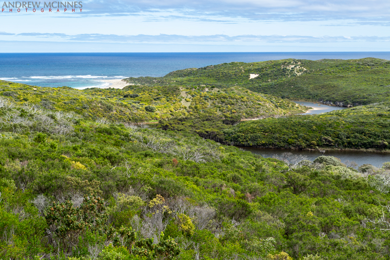
Margaret River Prevelly 2AM-001535 ©Andrew McInnes
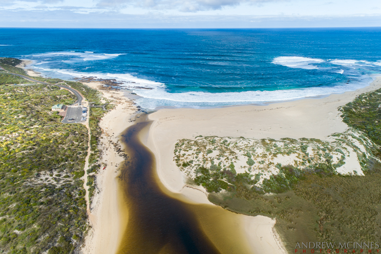
Margaret River Mouth 2AM-000272 ©Andrew McInnes
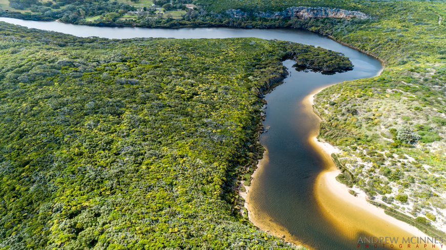
Margaret River Mouth 2AM 276-277-stitch ©Andrew McInnes
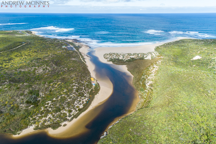
Margaret River Mouth 2AM-000278 ©Andrew McInnes
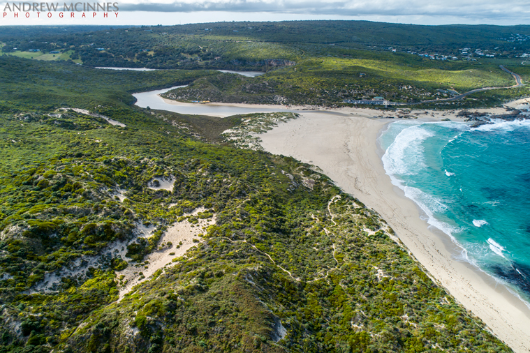
Margaret River Mouth 2AM-000288 ©Andrew McInnes
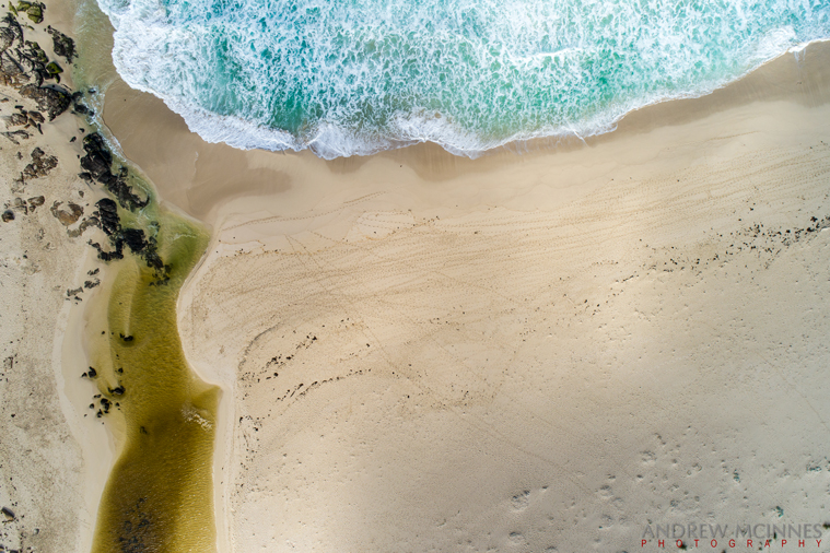
Margaret River Mouth 2AM-000280 ©Andrew McInnes
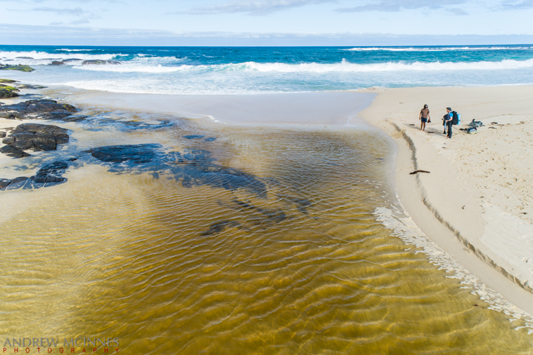
Margaret River Mouth 2AM-000309 ©Andrew McInnes
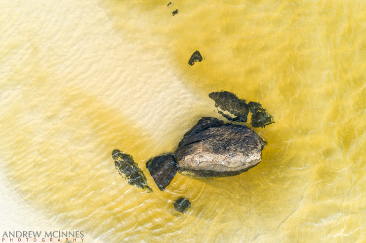
Margaret River Mouth 2AM-000304 ©Andrew McInnes
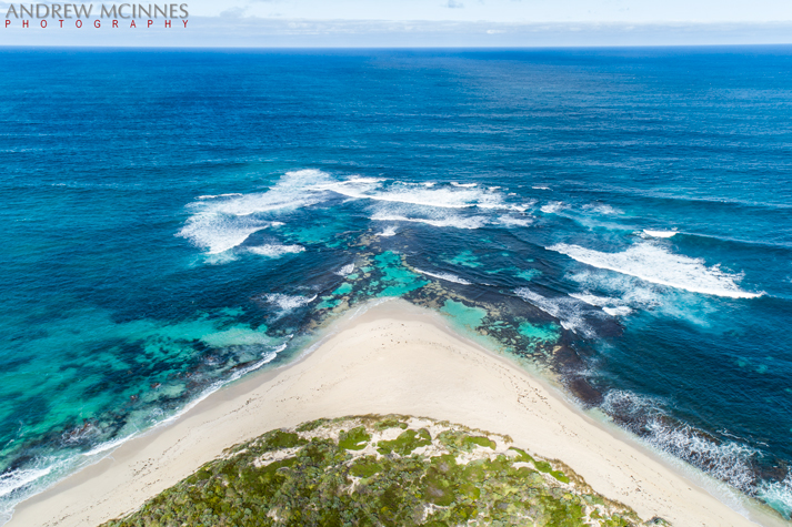
Margaret River Mouth 2AM-000286 ©Andrew McInnes
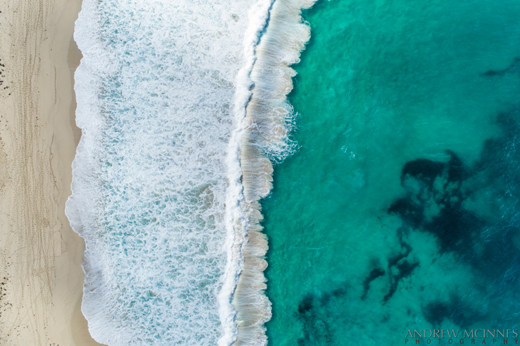
Margaret River Mouth 2AM-000294 ©Andrew McInnes
Moonlit Margaret River mouth.
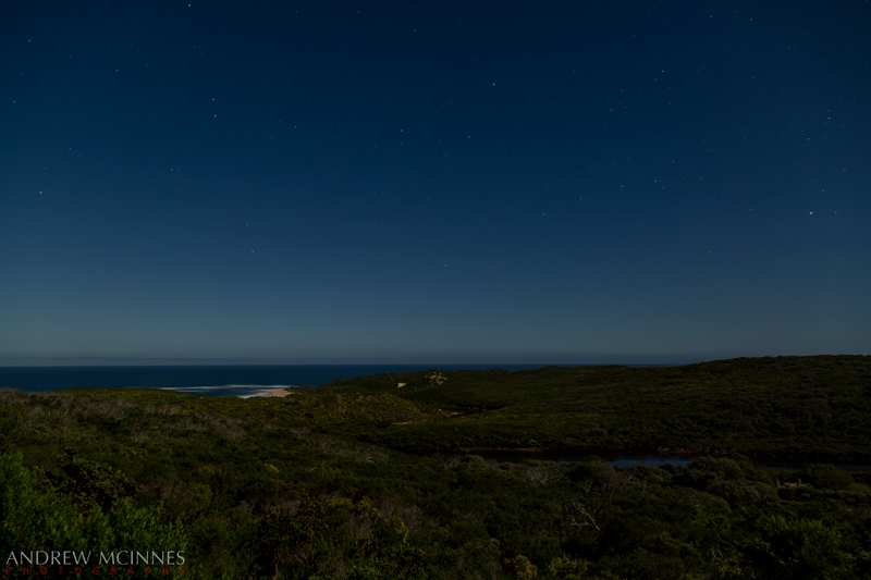
Margaret River Mouth 2AM 001532 NR ©Andrew McInnes
Cheers 🙂
Aerial views of Meelup Beach, Dunsborough, Western Australia.
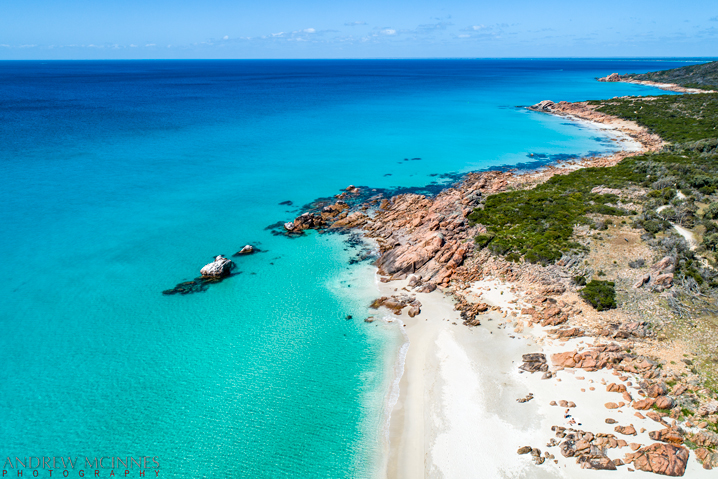
Meelup Beach 2AM-000312 ©Andrew McInnes
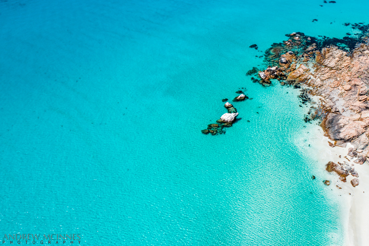
Meelup Beach 2AM-000313 ©Andrew McInnes
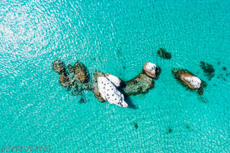
Meelup Beach 2AM-000317 ©Andrew McInnes
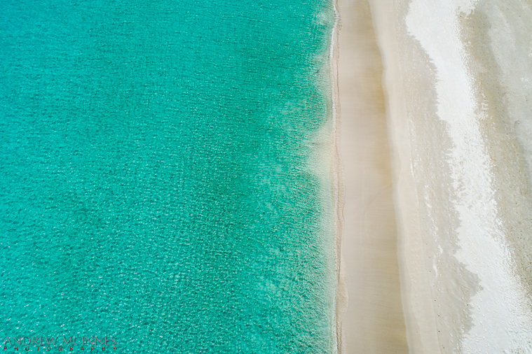
Meelup Beach 2AM-000326 ©Andrew McInnes
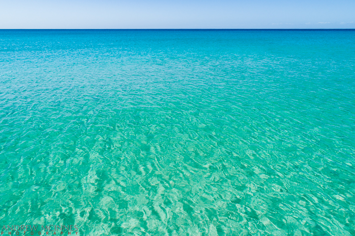
Meelup Beach 2AM-000330 ©Andrew McInnes
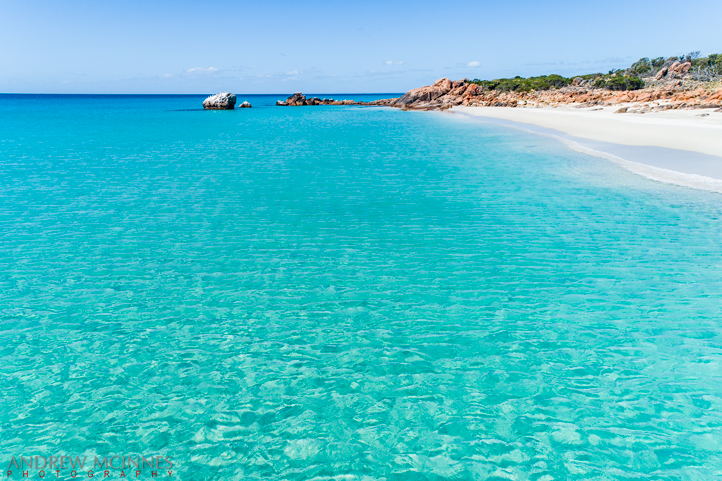
Meelup Beach 2AM-000331 ©Andrew McInnes
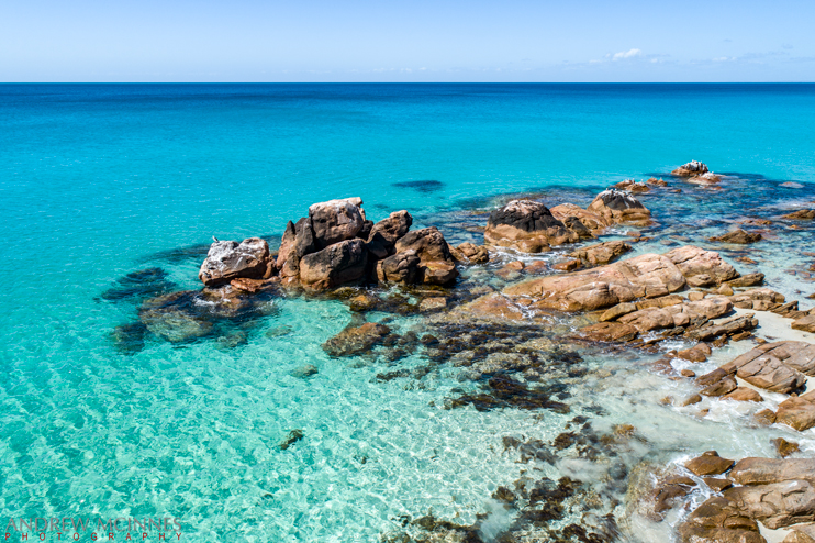
Meelup Beach 2AM-000342 ©Andrew McInnes
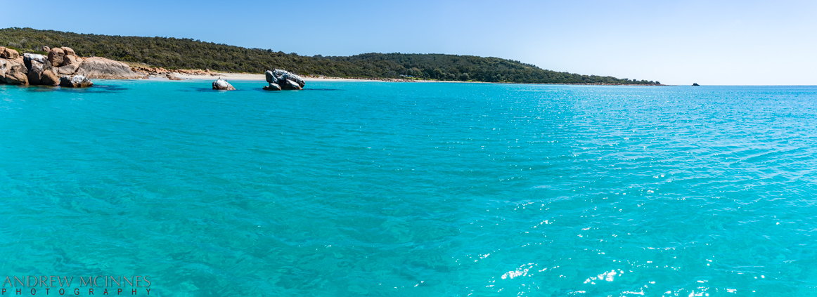
Meelup Beach 2AM-0337-0340 stitch
Cheers 🙂
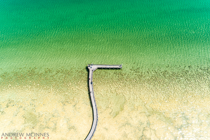
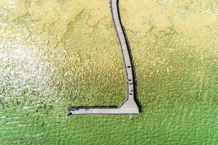
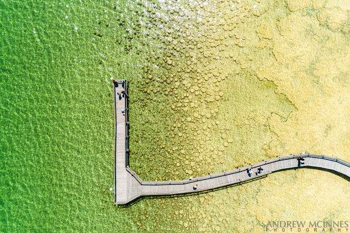
Aerial views of Thrombolites and boardwalk at Lake Clifton, Western Australia. These are the largest reef of living thrombolites in the southern hemisphere. To see ground-based images of these thrombolites, please visit an earlier photo-blog post of mine from 2012 here.
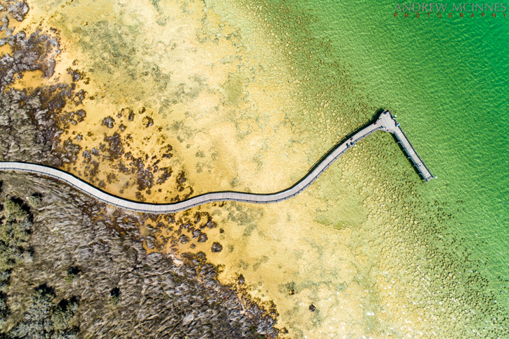
Lake Clifton Thrombolites 2AM-000241 ©Andrew McInnes
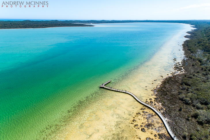
Lake Clifton Thrombolites 2AM-000237 ©Andrew McInnes
Lake Clifton Thrombolites 2AM-000239 ©Andrew McInnes

Lake Clifton Thrombolites 2AM-000245 ©Andrew McInnes
Lake Clifton Thrombolites 2AM-000247 ©Andrew McInnes
Cheers 🙂
Assorted images of Canal Rocks in Leeuwin-Naturaliste National Park – near Yallingup and Dunsborough, Western Australia. To see previous images of this location, see my post from 2012 here, and another from 2023 here.
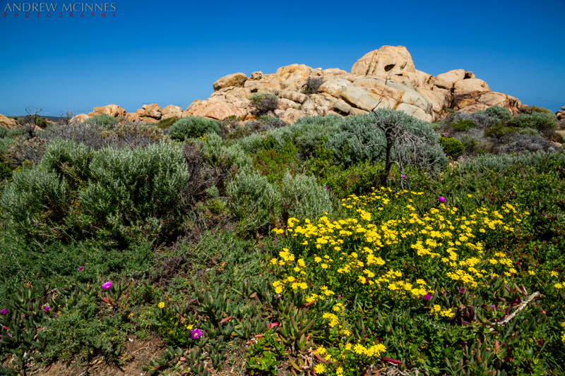
Canal Rocks 2AM-001600 ©Andrew McInnes
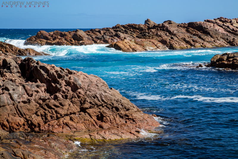
Canal Rocks 2AM-001611 ©Andrew McInnes
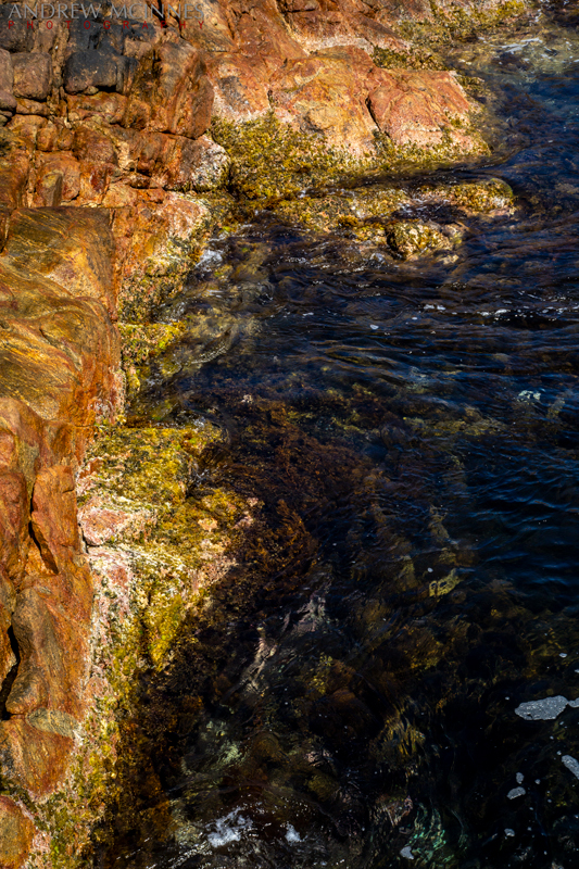
Canal Rocks 2AM-001622 ©Andrew McInnes
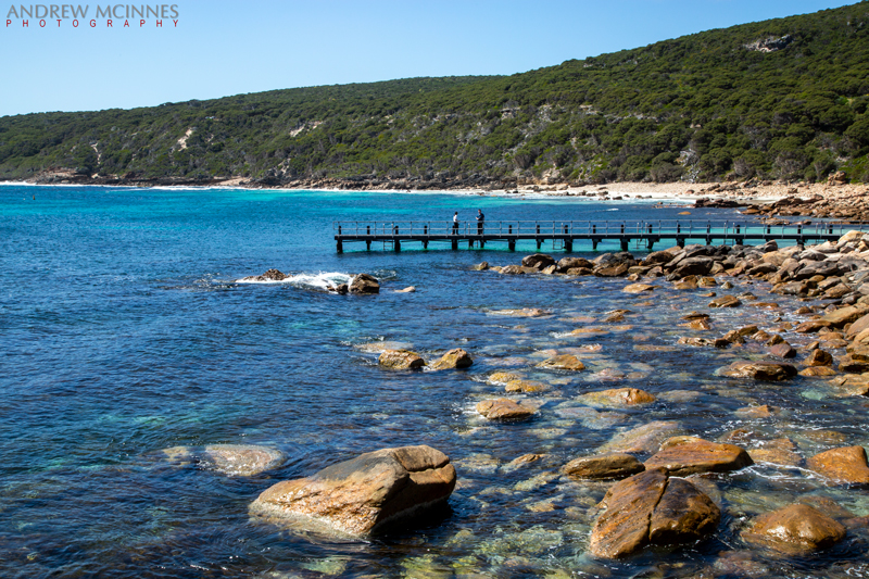
Canal-Rocks-2AM-001624 ©Andrew McInnes
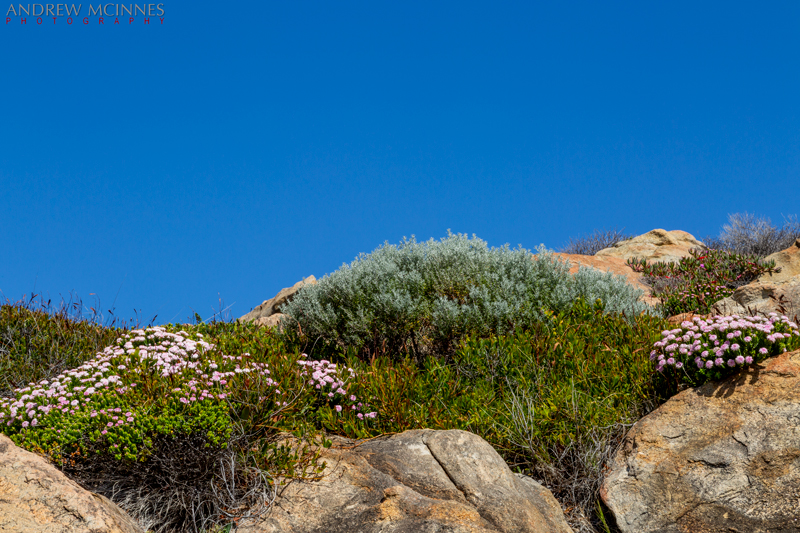
Canal Rocks 2AM-001625 ©Andrew McInnes
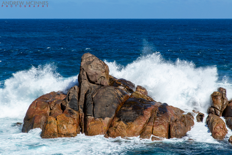
Canal Rocks 2AM-001647 ©Andrew McInnes
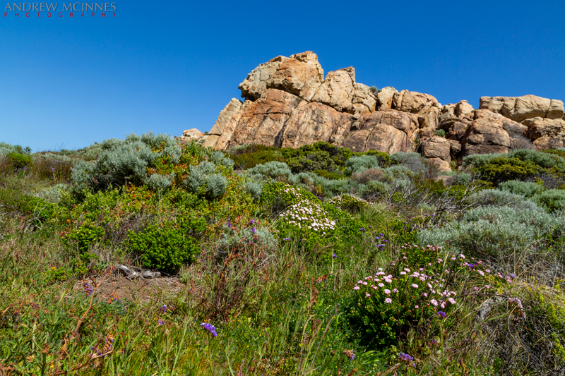
Canal Rocks 2AM-001681 ©Andrew McInnes
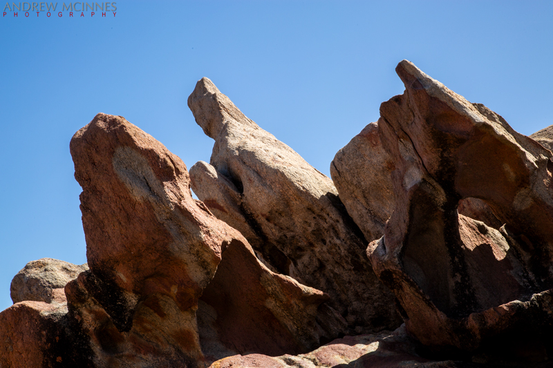
Canal Rocks 2AM-001686 ©Andrew McInnes
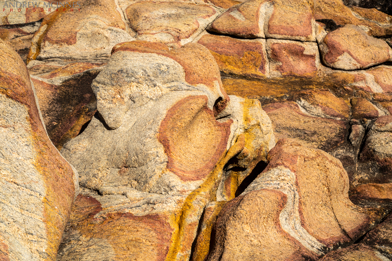
Canal Rocks 2AM-001688 ©Andrew McInnes
Cheers 🙂
Scenes from along Matilda Bay, on the Swan River, Perth.

Matilda Bay 2AM-000872 ©Andrew McInnes

Matilda Bay 2AM-000884 ©Andrew McInnes

Matilda Bay 2AM-000888 ©Andrew McInnes

Matilda Bay 2AM-000894 ©Andrew McInnes

Matilda Bay 2AM-000899 ©Andrew McInnes

Matilda Bay 2AM-000901 ©Andrew McInnes

Matilda Bay 2AM-000909 ©Andrew McInnes

Matilda Bay 2AM-000917 ©Andrew McInnes

Matilda Bay 2AM-001038 ©Andrew McInnes

Matilda Bay 2AM-001043 ©Andrew McInnes

Matilda Bay 2AM-001049 ©Andrew McInnes

Matilda Bay 2AM-001219 ©Andrew McInnes

Matilda Bay 2AM-001269 ©Andrew McInnes

Matilda Bay 2AM-001274 ©Andrew McInnes
Cheers 🙂
Bathers Beach, Fremantle.

Bathers Beach 2AM-000139 ©Andrew McInnes

Bathers Beach 2AM 0148-0150 stitch ©Andrew McInnes

Bathers Beach 2AM-000151 ©Andrew McInnes

Bathers Beach 2AM-000152 ©Andrew McInnes

Bathers Beach 2AM-001441 ©Andrew McInnes
Cheers 🙂
Winter rain and Moreton Bay Fig Trees.

Fig tree 2AM 1059-1071 crop ©Andrew McInnes

Fig tree 2AM-001072 ©Andrew McInnes

Fig tree 2AM-001073 ©Andrew McInnes

Fig tree 2AM-001081 ©Andrew McInnes

Fig tree 2AM-001084 ©Andrew McInnes

Fig tree 2AM-001087 ©Andrew McInnes

Fig tree 2AM-001089 ©Andrew McInnes

Fig tree 2AM-001095 ©Andrew McInnes

Fig tree 2AM-001117 ©Andrew McInnes

Fig tree 2AM 1130-1132 stack ©Andrew McInnes

Fig tree 2AM 1133-1135 stack ©Andrew McInnes
Cheers 🙂
Port Beach, Fremantle.

Port Beach 2AM 113-123 stitch ©Andrew McInnes

Port Beach 2AM 013-014 stitch ©Andrew McInnes

Port Beach 2AM-000096 ©Andrew McInnes

Port Beach 2AM-000109 ©Andrew McInnes

Port Beach 2AM 110-111 stitch ©Andrew McInnes

Port Beach 2AM-000124 ©Andrew McInnes

Port Beach 2AM-000126 ©Andrew McInnes

Port Beach 2AM-000129 ©Andrew McInnes

Port Beach 2AM-000131 ©Andrew McInnes

Port Beach 2AM-000137 ©Andrew McInnes

Port Beach 2AM-000138 ©Andrew McInnes
Cheers 🙂
A stunning and quickly morphing sunrise over South Perth, viewed from Matilda Bay, on the Swan River.

Matilda Bay 2AM-000866 ©Andrew McInnes

Matilda Bay 2AM-000871 ©Andrew McInnes

Matilda Bay 2AM-004829 ©Andrew McInnes
Cheers 🙂
A Madeira registered container ship departs the Port of Fremantle, Western Australia.

Fremantle Harbour 2AM-001281 ©Andrew McInnes

Fremantle Harbour 2AM-001285 ©Andrew McInnes

Fremantle Harbour 2AM-001289 ©Andrew McInnes

Fremantle Harbour 2AM-001290 ©Andrew McInnes

Fremantle Harbour 2AM-001293 ©Andrew McInnes

Fremantle Harbour 2AM-001297 ©Andrew McInnes
Cheers 🙂
Sun and rain and rainbow over the Crawley Edge Boatshed. This little boathouse is a magnet for the “insta” crowd, with crowds lined up daily to get their images here.

Crawley Edge Boatshed 1007-1010 stack ©Andrew McInnes

Crawley Edge Boatshed 1017-1019 stack ©Andrew McInnes

Crawley Edge Boatshed 2AM-001189 ©Andrew McInnes

Crawley Edge Boatshed 2AM-001025 ©Andrew McInnes

Crawley Edge Boatshed 2AM-001167 ©Andrew McInnes

Crawley Edge Boatshed 2AM-001168 ©Andrew McInnes

Crawley Edge Boatshed 2AM-001174 ©Andrew McInnes

Crawley Edge Boatshed 2AM-001176 ©Andrew McInnes

Crawley Edge Boatshed 2AM-001180 ©Andrew McInnes

Crawley Edge Boatshed 2AM-004866 ©Andrew McInnes

Crawley Edge Boatshed 2AM-004869 ©Andrew McInnes

Crawley Edge Boatshed 2AM-004877 ©Andrew McInnes

Swan River Rainbow 2AM-001178 ©Andrew McInnes
Cheers 🙂
Underside of the Stirling Bridge in Fremantle.

Stirling Bridge 2AM-000011 ©Andrew McInnes

Stirling Bridge 2AM-001346 ©Andrew McInnes
Cheers 🙂
Winter warmth at South Beach, Fremantle.

South Beach 2AM-000163 ©Andrew McInnes

South Beach 2AM-000160 ©Andrew McInnes

South Beach 2AM-000154 stitch ©Andrew McInnes

South Beach 2AM-000524 ©Andrew McInnes
Incoming storm, incredible light!

South Fremantle 2AM-000286 ©Andrew McInnes
Cheers 🙂
Winter rain reflections at Cottesloe Beach.

Cottesloe Beach 2AM-001165 ©Andrew McInnes
Cheers 🙂
Rainbow (‘The Containbow’) by Perth artist Marcus Canning.

The Containbow 2AM-001302 ©Andrew McInnes

The Containbow 2AM-001298 ©Andrew McInnes

The Containbow 2AM-001301 ©Andrew McInnes

The Containbow 2AM-001306 ©Andrew McInnes

The Containbow 2AM-001313 ©Andrew McInnes

The Containbow 2AM-001314 ©Andrew McInnes

The Containbow 2AM-001320 ©Andrew McInnes

The Containbow 2AM-001326 ©Andrew McInnes
Cheers 🙂
Assorted images (digital SLR and drone) of Sugarloaf Rock in Leeuwin-Naturaliste National Park, near Yallingup and Dunsborough, Western Australia. For a sunset view of this scene, see my photo-essay from 2012 here.

Sugarloaf Rock 2AM-000235 ©Andrew McInnes

Sugarloaf Rock 2AM-000199 ©Andrew McInnes

Sugarloaf Rock 2AM-000228 ©Andrew McInnes

Sugarloaf Rock 2AM-000229 ©Andrew McInnes

Sugarloaf Rock 2AM-000225 ©Andrew McInnes

Sugarloaf Rock 2AM-000200 ©Andrew McInnes

Sugarloaf Rock 2AM-000202 ©Andrew McInnes

Sugarloaf Rock 2AM-000204 ©Andrew McInnes

Sugarloaf Rock 2AM 0216_0219 stitch ©Andrew McInnes

Sugarloaf Rock 2AM-000223 ©Andrew McInnes

Sugarloaf Rock 2AM-000224 ©Andrew McInnes

Sugarloaf Rock 2AM-000081 ©Andrew McInnes

Sugarloaf Rock 2AM-000072 ©Andrew McInnes
Cheers 🙂
A few images from the campus of the University of Western Australia in Perth.

UWA 2AM-000277 ©Andrew McInnes

UWA 2AM-000941 ©Andrew McInnes

UWA 2AM-000956 ©Andrew McInnes

UWA 2AM-000938 ©Andrew McInnes

UWA 2AM-000951 ©Andrew McInnes

UWA 2AM-000964 ©Andrew McInnes

UWA 2AM-000969 ©Andrew McInnes

UWA 2AM-000950 ©Andrew McInnes

Autumn Leaves 2AM-001203 Andrew McInnes

Autumn Leaves 2AM-001199 ©Andrew McInnes

UWA-2AM-004856 ©Andrew McInnes

UWA 2AM-004863 ©Andrew McInnes

UWA 2AM-000343 ©Andrew McInnes
Cheers 🙂
STS Leeuwin II (Sail Training Ship) returning to its home port of Fremantle, Western Australia, on August 18, 2023.
Some 30 plus years ago I was privileged to spend some blocks of time voyaging on two different square-rigged ships, one off the east coast of Australia, and the other off the west coast – the latter of which was this aboard this particular ship – STS Leeuwin II.

STS Leeuwin II 2AM-000028 ©Andrew McInnes

STS Leeuwin II 2AM-000029 ©Andrew McInnes

STS Leeuwin II 2AM-000035 ©Andrew McInnes

STS Leeuwin II 2AM-000036 ©Andrew McInnes

STS Leeuwin II 2AM-000031 ©Andrew McInnes
The North Mole Lighthouse – welcome home.

North Mole Lighthouse 2AM-001457 ©Andrew McInnes
Cheers 🙂
Assorted aerial (drone) images of Canal Rocks in Leeuwin-Naturaliste National Park – near Yallingup and Dunsborough, Western Australia. To see images with larger waves at this location, see my post from 2012 here.

Canal Rocks 2AM-0167-0168 stitch ©Andrew McInnes

Canal Rocks 2AM-000177 ©Andrew McInnes

Canal Rocks 2AM-0178_0180 stitch ©Andrew McInnes

Canal Rocks 2AM-000181 ©Andrew McInnes

Canal Rocks 2AM-000173 ©Andrew McInnes

Canal Rocks 2AM-000185 ©Andrew McInnes

Canal Rocks 2AM-000186 ©Andrew McInnes

Canal Rocks 2AM-000188 ©Andrew McInnes

Canal Rocks 2AM-000190 ©Andrew McInnes

Canal Rocks 2AM-000196 ©Andrew McInnes
Cheers 🙂
Aerials, mostly – Toogoom, Queensland.

Toogoom 2AM 942_944 stitch ©Andrew McInnes

Toogoom 2AM-000949 ©Andrew McInnes

Toogoom 2AM-000931 ©Andrew McInnes

Toogoom 2AM-000930 ©Andrew McInnes

Toogoom 2AM-000929 ©Andrew McInnes

Toogoom 2AM-000925 ©Andrew McInnes

Toogoom 2AM-000952 ©Andrew McInnes

Toogoom 2AM-000924 ©Andrew McInnes

Toogoom 2AM-000932 ©Andrew McInnes

Toogoom 2AM-000951 ©Andrew McInnes

Toogoom 2AM-000954 ©Andrew McInnes

Toogoom 2AM-000962 ©Andrew McInnes

Toogoom 2AM-000955 ©Andrew McInnes

Toogoom 2AM-000940 ©Andrew McInnes

Toogoom 2AM-004267 ©Andrew McInnes
Cheers 🙂
This photo essay shows a portion of the experience of the 2022 Eidsvold Cattle Drive.

Eidsvold Cattle Drive 2AM-000884 ©Andrew McInnes

Eidsvold Cattle Drive 2AM-000136 ©Andrew McInnes

Eidsvold Cattle Drive 2AM-009982 ©Andrew McInnes

Eidsvold Cattle Drive 2AM-003524 ©Andrew McInnes

Eidsvold Cattle Drive 2AM-003403 ©Andrew McInnes

Eidsvold Cattle Drive 2AM-003336 ©Andrew McInnes

Eidsvold Cattle Drive 2AM-003280 ©Andrew McInnes

Eidsvold Cattle Drive 2AM-003150 ©Andrew McInnes

Eidsvold Cattle Drive 2AM-003055 ©Andrew McInnes

Eidsvold Cattle Drive 2AM-003041 ©Andrew McInnes

Eidsvold Cattle Drive 2AM-003917 ©Andrew McInnes

Eidsvold Cattle Drive 2AM-000885 ©Andrew McInnes

Eidsvold Cattle Drive 2AM-0034600 ©Andrew McInnes

Eidsvold Cattle Drive 2AM-003835 ©Andrew McInnes

Eidsvold Cattle Drive 2AM-003825 ©Andrew McInnes

Eidsvold Cattle Drive 2AM-003716 ©Andrew McInnes

Eidsvold Cattle Drive 2AM-003573 ©Andrew McInnes

Eidsvold Cattle Drive 2AM-003275 ©Andrew McInnes

Eidsvold Cattle Drive 2AM-003223 ©Andrew McInnes

Eidsvold Cattle Drive 2AM-003220 ©Andrew McInnes

Eidsvold Cattle Drive 2AM-003166 ©Andrew McInnes

Eidsvold Cattle Drive 2AM-003024 ©Andrew McInnes

Eidsvold Cattle Drive 2AM-002934 ©Andrew McInnes

Eidsvold Cattle Drive 2AM-002788 ©Andrew McInnes

Eidsvold Cattle Drive 2AM-000883 ©Andrew McInnes

Eidsvold Cattle Drive 2AM-000854 ©Andrew McInnes

Eidsvold Cattle Drive 2AM-000290 ©Andrew McInnes

Eidsvold Cattle Drive 2AM-000281 ©Andrew McInnes

Eidsvold Cattle Drive 2AM-000280 ©Andrew McInnes

Eidsvold Cattle Drive 2AM-000190 ©Andrew McInnes

Eidsvold Cattle Drive 2AM-000121 ©Andrew McInnes
So there you go, a sample of the experience.
Cheers 🙂
Aerial images of Round Hill Head, at the Town of 1770, Queensland.

Seventeen Seventy 2AM-000798
©Andrew McInnes

Seventeen Seventy 2AM-000794
©Andrew McInnes

Seventeen Seventy 2AM-000801
©Andrew McInnes

Seventeen Seventy 2AM-000804
©Andrew McInnes

Seventeen Seventy 2AM-000793
©Andrew McInnes
Cheers 🙂
This is a multi-image panorama at low tide of the 1770 Camping Ground, Queensland.

Seventeen Seventy 2AM 9354-9378 stitch
©Andrew McInnes
Cheers 🙂
Aerial images of Round Hill Creek, at the Town of 1770, Queensland.

Seventeen Seventy 2AM 0769-0778 stitch
©Andrew McInnes

Seventeen Seventy 2AM-000742
©Andrew McInnes

Seventeen Seventy 2AM-000743
©Andrew McInnes

Seventeen Seventy 2AM-000744
©Andrew McInnes

Seventeen Seventy 2AM-000745
©Andrew McInnes

Seventeen Seventy 2AM-000766
©Andrew McInnes

Seventeen Seventy 2AM-000786
©Andrew McInnes

Seventeen Seventy 2AM-0703-0715 stitch
©Andrew McInnes

Seventeen Seventy 2AM 0736-0740 stitch
©Andrew McInnes

Seventeen Seventy 2AM-0746-0748 stitch
©Andrew McInnes

Seventeen Seventy 2AM-0749-0756 stitch
©Andrew McInnes

Seventeen Seventy 2AM-0757-0765 stitch
©Andrew McInnes

Seventeen Seventy 2AM-000735
©Andrew McInnes
Cheers 🙂
Boats at rest during a tranquil sunset on Round Hill Creek – the Town of 1770, Queensland.

Seventeen Seventy 2AM-009255 ©Andrew McInnes

Seventeen Seventy 2AM-009260 ©Andrew McInnes

Seventeen Seventy 2AM-009401 ©Andrew McInnes

Seventeen Seventy 2AM-009545 ©Andrew McInnes

Seventeen Seventy 2AM-009552 ©Andrew McInnes

Seventeen Seventy 2AM-009556 ©Andrew McInnes

Seventeen Seventy 2AM-009571 ©Andrew McInnes
Cheers 🙂
A few images from the Paperbark Forest Boardwalk in Reedy Creek Reserve, near the town of Agnes Water, Queensland.
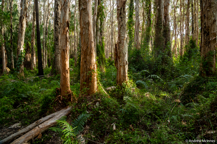
Paperbark Forest Boardwalk 2AM-009464 ©Andrew McInnes
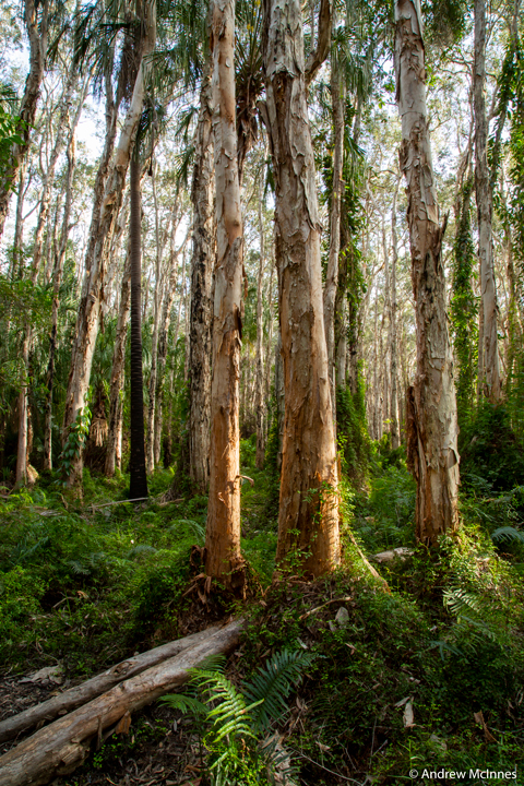
Paperbark Forest Boardwalk 2AM-009467 ©Andrew McInnes
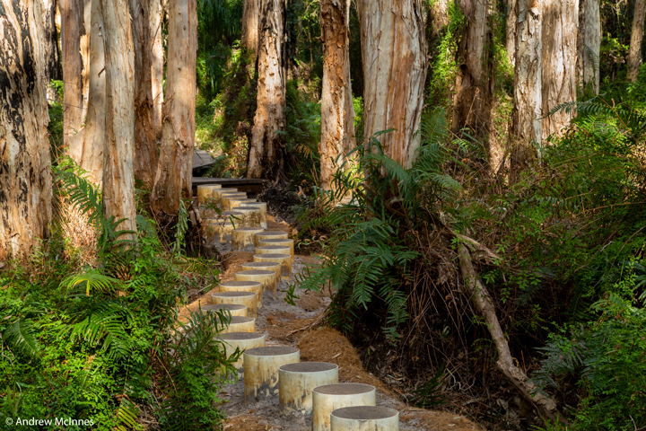
Paperbark Forest Boardwalk 2AM-009483 ©Andrew McInnes
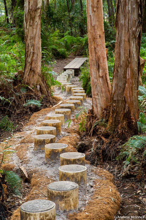
Paperbark Forest Boardwalk 2AM-009449 ©Andrew McInnes

Paperbark Forest Boardwalk 2AM-009450 ©Andrew McInnes

Paperbark Forest Boardwalk 2AM-009453 ©Andrew McInnes
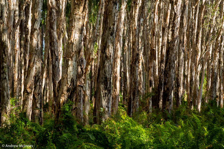
Paperbark Forest Boardwalk 2AM-009480 ©Andrew McInnes
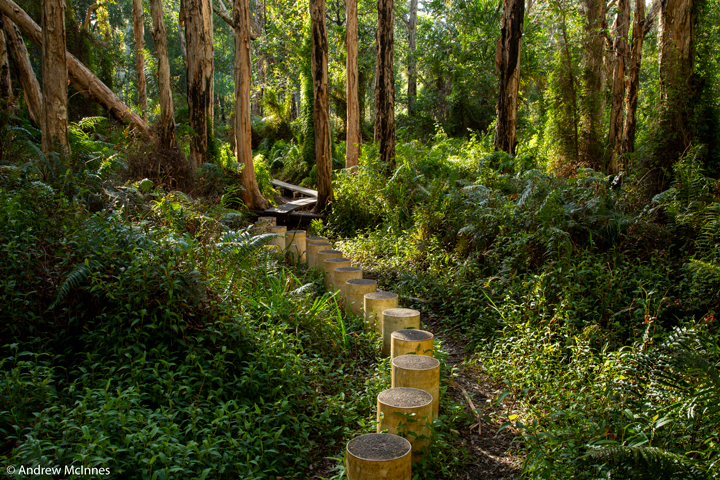
Paperbark Forest Boardwalk 2AM-009473 ©Andrew McInnes
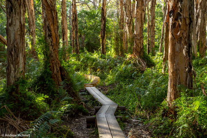
Paperbark Forest Boardwalk 2AM-009470 ©Andrew McInnes
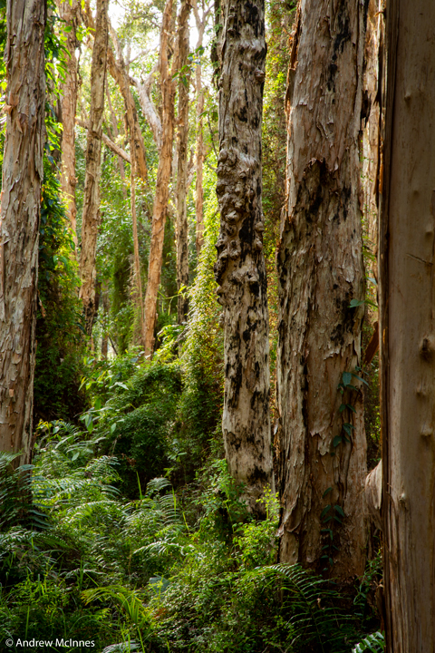
Paperbark Forest Boardwalk 2AM-009461
Cheers 🙂
Early morning on Bustard Bay Lookout at the Town of 1770, Queensland.

Seventeen Seventy 2AM-009282
©Andrew McInnes
Seventeen Seventy 2AM-009285
©Andrew McInnes
Seventeen-Seventy-2AM-009286
©Andrew McInnes
Seventeen Seventy 2AM-009316
©Andrew McInnes
Seventeen Seventy 2AM-000803
©Andrew McInnes
Cheers 🙂
A visit with an old friend afforded me a little spare time to capture a little series of aerial images around Noosa, Queensland.

Noosa 2AM-000472
©Andrew McInnes

Noosa 2AM 0457-0458 stitch
©Andrew McInnes

Noosa 2AM-000429
©Andrew McInnes

Noosa 2AM-000427
©Andrew McInnes

Noosa 2AM 0403-0406 stitch
©Andrew McInnes

Noosa 2AM-000409
©Andrew McInnes

Noosa 2AM 0414-0422 stitch
©Andrew McInnes
Cheers 🙂
These images are from documenting the Drought Busters 2018 hay run to Thargomindah, in western Queensland. It was bloody dry with not a blade of grass to be found, and although good rains have recently fallen, our battling bushies still have a long row to hoe. My movie of the hay run can be found by clicking here or on the “movies” tab on my webpage.

Drought Busters 2AM 0110-0117 stitch
©Andrew McInnes

Drought Busters 2AM-007320
©Andrew McInnes

Drought Busters 2AM-007172
©Andrew McInnes

Drought Busters 2AM-007173
©Andrew McInnes

Drought Busters 2AM-007137
©Andrew McInnes

Drought Busters 2AM-007195
©Andrew McInnes

Drought Busters 2AM-007196
©Andrew McInnes

Drought Busters 2AM-007257
©Andrew McInnes

Drought Busters 2AM 0077-0079 stitch
©Andrew McInnes

Drought Busters 2AM 0086-0088 stitch
©Andrew McInnes

Drought Busters 2AM-000067
©Andrew McInnes

Drought Busters 2AM-000070
©Andrew McInnes

Drought Busters 2AM-000073
©Andrew McInnes

Drought Busters 2AM-000076
©Andrew McInnes

Drought Busters 2AM-000081
©Andrew McInnes

Drought Busters 2AM-000092
©Andrew McInnes

Drought Busters 2AM-000098
©Andrew McInnes

Drought Busters 2AM-000100
©Andrew McInnes

Drought Busters 2AM-000104
©Andrew McInnes

Drought Busters 2AM-000106
©Andrew McInnes

Drought Busters 2AM-000108
©Andrew McInnes

Drought Busters 2AM-000118
©Andrew McInnes

Drought Busters 2AM-000125
©Andrew McInnes

Drought Busters 2AM-007208
©Andrew McInnes

Drought Busters 2AM-000129
©Andrew McInnes

Drought Busters 2AM-000131
©Andrew McInnes

Drought Busters 2AM-000137
©Andrew McInnes

Drought Busters 2AM-000139
©Andrew McInnes

Drought Busters 2AM-000142
©Andrew McInnes

Drought Busters 2AM-000301
©Andrew McInnes

Drought Busters 2AM-000308
©Andrew McInnes

Drought Busters 2AM 7210-7213 stack
©Andrew McInnes
Cheers 🙂
These images are from a recently completed construction and architectural shoot for a client on the Sunshine Coast, Queensland.
The house is stunning, with views to match!

2AM 000005-000012 pano
©Andrew McInnes

2AM-0001
©Andrew McInnes

2AM 000977-000978 Pano
©Andrew McInnes

2AM 000043-0051 Pano
©Andrew McInnes

2AM 000014-0016 pano
©Andrew McInnes

2AM 007049-007051 stack
©Andrew McInnes

2AM 007058-007060 stack
©Andrew McInnes

2AM 007031-007033 stack
©Andrew McInnes

2AM 007019-007021 stack
©Andrew McInnes

2AM 001306-001308 stack
©Andrew McInnes

2AM 001294-001296 stack
©Andrew McInnes

2AM 001270-001272 stack
©Andrew McInnes

2AM 001285-001287 stack
©Andrew McInnes

2AM 001327-001335 stack
©Andrew McInnes

2AM 001456-001461 stack
©Andrew McInnes

2AM 001237-1245 stack
©Andrew McInnes

2AM 001261-001263 stack
©Andrew McInnes

2AM 001342-001344 stack
©Andrew McInnes

2AM 001267-001269 stack
©Andrew McInnes

2AM 001624-001629 stack
©Andrew McInnes

2AM 001630-001632 stack
©Andrew McInnes

2AM 001468-001470 stack
©Andrew McInnes

2AM 001471-001476 stack
©Andrew McInnes

2AM 001372-001377 stack
©Andrew McInnes

2AM 001351-001353 stack
©Andrew McInnes

2AM 001381-001389 stack
©Andrew McInnes

2AM 001450-001455 stack
©Andrew McInnes

2AM 001444-001449 stack
©Andrew McInnes

2AM 001399-001401 stack
©Andrew McInnes

2AM 001402-001404 stack
©Andrew McInnes

2AM 001426-001431 stack
©Andrew McInnes

2AM 001438-001443 stack
©Andrew McInnes

2AM 001354-001356 stack
©Andrew McInnes

2AM 001360-001362 stack
©Andrew McInnes

2AM 001369-001371 stack
©Andrew McInnes

2AM 001537-001542 stack
©Andrew McInnes

2AM 001522-001530 stack
©Andrew McInnes

2AM 001516-001518 stack
©Andrew McInnes

2AM 001507-001515 stack
©Andrew McInnes

2AM 001489-001491 stack
©Andrew McInnes

2AM 001480-001485 stack
©Andrew McInnes

2AM 001462-001467 stack
©Andrew McInnes

2AM 001560
©Andrew McInnes

2AM 001570-001572 stack
©Andrew McInnes

2AM 001567-001569 stack
©Andrew McInnes

2AM 001213-001215 stack
©Andrew McInnes

2AM 007085-007087 stack
©Andrew McInnes
Cheers 🙂
A series of images of Double Island Point, Carlo Sand Blow, and Carlo Point during an express visit with friends who live in this beautiful area – Rainbow Beach, Queensland.
Sunset viewed from Carlo Sandblow.

Carlo Sandblow 2AM 0840-0846 stitch
©Andrew McInnes

Carlo Sandblow 2AM-006744
©Andrew McInnes

Carlo Sandblow 2AM-006747
©Andrew McInnes

Carlo Sandblow 2AM-006753
©Andrew McInnes

Carlo Sandblow 2AM-006757
©Andrew McInnes
Early morning and sunrise at Carlo Sand Blow.

Carlo Sandblow 2AM-006764
©Andrew McInnes

Carlo Sandblow 2AM 6776-6778 stitch
©Andrew McInnes

Carlo Sandblow 2AM 6779-6784 stitch
©Andrew McInnes

Carlo Sandblow 2AM-000893
©Andrew McInnes

Carlo Sandblow 2AM 0860-0864 stitch
©Andrew McInnes

Carlo Sandblow 2AM 6873-6894 stitch
©Andrew McInnes

Carlo Sandblow 2AM 0880-0892 stitch
©Andrew McInnes
Double Island Point.

Double Island Point 2AM 899-911 stitch
©Andrew McInnes

Double Island Point 2AM-000929
©Andrew McInnes

Double Island Point 2AM-000930
©Andrew McInnes

Double Island Point 2AM-000931
©Andrew McInnes
Carlo Point, on the estuary side of Rainbow Beach.

Carlo Point 2AM-000932 ©Andrew McInnes
Estuarine leachate funnelling off tidal flats during ebb tide…

Carlo Point 2AM-000938 ©Andrew McInnes

Carlo Point 2AM-000940 ©Andrew McInnes

Carlo Point 2AM-000942 ©Andrew McInnes

Carlo Point 2AM-000944 ©Andrew McInnes

Carlo Point 2AM 0946-0948 stitch
©Andrew McInnes

Carlo Point 2AM-000969
©Andrew McInnes

Carlo Point 2AM-000970
©Andrew McInnes
Cheers 🙂
This photo essay shows a portion of the experience of the 2018 Eidsvold Cattle Drive. To watch a short video I made of the 2018 cattle drive, click here.
The second running of this cattle drive occurred 8th-14th April, 2018.

ECCD_2018 2AM-00039111 ©Andrew McInnes

ECCD_2018 2AM-00045311 ©Andrew McInnes

ECCD_2018 2AM-00051011 ©Andrew McInnes

ECCD_2018 2AM-00051111 ©Andrew McInnes

ECCD_2018 2AM-0000161 ©Andrew McInnes

ECCD_2018 2AM-0000271 ©Andrew McInnes

ECCD_2018 2AM-0000361 ©Andrew McInnes

ECCD_2018 2AM-0000511 ©Andrew McInnes

ECCD_2018 2AM-0001191 ©Andrew McInnes

ECCD_2018 2AM-0001781 ©Andrew McInnes

ECCD_2018 2AM-0001831 ©Andrew McInnes

ECCD_2018 2AM-0001921 ©Andrew McInnes

ECCD_2018 2AM-0003931 ©Andrew McInnes

ECCD_2018 2AM-000405 ©Andrew McInnes

ECCD_2018 2AM-0004141 ©Andrew McInnes

ECCD_2018 2AM-000426 ©Andrew McInnes

ECCD_2018 2AM-0005021 ©Andrew McInnes

ECCD_2018 2AM-0005301 ©Andrew McInnes

ECCD_2018 2AM-0005372 ©Andrew McInnes

ECCD_2018 2AM-000542 ©Andrew McInnes

ECCD_2018 2AM-0005641 ©Andrew McInnes

ECCD_2018 2AM-0005781 ©Andrew McInnes

ECCD_2018 2AM 0591-0595 stitch ©Andrew McInnes

ECCD_2018 2AM-0006031 ©Andrew McInnes

ECCD_2018 2AM-00006261 ©Andrew McInnes

ECCD_2018 2AM-00006291 ©Andrew McInnes

ECCD_2018 2AM-0000633 ©Andrew McInnes

ECCD_2018 2AM-0006371 ©Andrew McInnes

ECCD_2018 2AM 0645-0651 stitch ©Andrew McInnes

ECCD_2018 2AM-0006671 ©Andrew McInnes

ECCD_2018 2AM-00006811 ©Andrew McInnes

ECCD_2018 2AM-0007261 ©Andrew McInnes

ECCD_2018 2AM-0008601 ©Andrew McInnes

ECCD_2018 2AM-0008611 ©Andrew McInnes

ECCD_2018 2AM-0008701 ©Andrew McInnes

ECCD_2018 2AM-0008861 ©Andrew McInnes

ECCD_2018 2AM-0009301 ©Andrew McInnes

ECCD_2018 2AM-0009391 ©Andrew McInnes

ECCD_2018 2AM-0010021 ©Andrew McInnes

ECCD_2018 2AM-0010781 ©Andrew McInnes

ECCD_2018 2AM-0010891 ©Andrew McInnes

ECCD_2018 2AM-0010911 ©Andrew McInnes

ECCD_2018 2AM-0010981 ©Andrew McInnes

ECCD_2018 2AM-0011031 ©Andrew McInnes

ECCD_2018 2AM-0064121 ©Andrew McInnes

ECCD_2018 2AM-0007531 ©Andrew McInnes

ECCD_2018 2AM-0007581 ©Andrew McInnes

ECCD_2018 2AM-0011451 ©Andrew McInnes

ECCD_2018 2AM-001152 ©Andrew McInnes

ECCD_2018 2AM-0001791 ©Andrew McInnes

ECCD_2018 2AM-0002001 ©Andrew McInnes

ECCD_2018 2AM-00022011 ©Andrew McInnes

ECCD_2018 2AM-00022811 ©Andrew McInnes

ECCD_2018 2AM-00051411 ©Andrew McInnes

ECCD_2018 2AM-00053711 ©Andrew McInnes

ECCD_2018 2AM 5474-5477 stack ©Andrew McInnes

ECCD_2018 2AM-0054801 ©Andrew McInnes

ECCD_2018 2AM-0054901 ©Andrew McInnes

ECCD_2018 2AM-005503 ©Andrew McInnes

ECCD_2018 2AM 5549-5550 stitch ©Andrew McInnes

ECCD_2018 2AM-0055881 ©Andrew McInnes

ECCD_2018 2AM 5592-5620 stack ©Andrew McInnes

ECCD_2018 2AM 5633-5643 stitch ©Andrew McInnes

ECCD_2018 2AM-0056921 ©Andrew McInnes

ECCD_2018 2AM-0057521 ©Andrew McInnes

ECCD_2018 2AM-005816 ©Andrew McInnes

ECCD_2018 2AM-0058731 ©Andrew McInnes

ECCD_2018 2AM-0059051 ©Andrew McInnes

ECCD_2018 2AM-0059291 ©Andrew McInnes

ECCD_2018 2AM-0059481 ©Andrew McInnes

ECCD_2018 2AM-0059551 ©Andrew McInnes

ECCD_2018 2AM-0059761 ©Andrew McInnes

ECCD_2018 2AM-0059831 ©Andrew McInnes

ECCD_2018 2AM-0060291 ©Andrew McInnes

ECCD_2018 2AM-0060571 ©Andrew McInnes

ECCD_2018 2AM-0060691 ©Andrew McInnes

ECCD_2018 2AM-0060711 ©Andrew McInnes

ECCD_2018 2AM-006091 ©Andrew McInnes

ECCD_2018 2AM-0061041 ©Andrew McInnes

ECCD_2018 2AM-0061501 ©Andrew McInnes

ECCD_2018 2AM-0061731 ©Andrew McInnes

ECCD_2018 2AM-0061801 ©Andrew McInnes

ECCD_2018 2AM-0061831 ©Andrew McInnes

ECCD_2018 2AM-0061921 ©Andrew McInnes

ECCD_2018 2AM-0062091 ©Andrew McInnes

ECCD_2018 2AM-00061811 ©Andrew McInnes

ECCD_2018 2AM-00062111 ©Andrew McInnes

ECCD_2018 2AM-00062311 ©Andrew McInnes

ECCD_2018 2AM-0062211 ©Andrew McInnes

ECCD_2018 2AM-0062401 ©Andrew McInnes

ECCD_2018 2AM-0062951 ©Andrew McInnes

ECCD_2018 2AM-0062981 ©Andrew McInnes

ECCD_2018 2AM-0063081 ©Andrew McInnes

ECCD_2018 2AM-0063151 ©Andrew McInnes

ECCD_2018 2AM-0063171 ©Andrew McInnes

ECCD_2018 2AM-0063291 ©Andrew McInnes

ECCD_2018 2AM-0063301 ©Andrew McInnes

ECCD_2018 2AM-0063331 ©Andrew McInnes

ECCD_2018 2AM-0064051 ©Andrew McInnes

ECCD_2018 2AM-0064671 ©Andrew McInnes

ECCD_2018 2AM-0064681 ©Andrew McInnes

ECCD_2018 2AM-0064711 ©Andrew McInnes

ECCD_2018 2AM-0064731 ©Andrew McInnes

ECCD_2018 2AM-0064841 ©Andrew McInnes

ECCD_2018 2AM-0064821 ©Andrew McInnes

ECCD_2018 2AM-0064801 ©Andrew McInnes

ECCD_2018 2AM-0007031 ©Andrew McInnes

ECCD_2018 2AM-0007251 ©Andrew McInnes

ECCD_2018 2AM 7291-7331 stitch ©Andrew McInnes

ECCD_2018 2AM-0007701 ©Andrew McInnes

ECCD_2018 2AM-0007741 ©Andrew McInnes

ECCD_2018 2AM-00077611 ©Andrew McInnes

ECCD_2018 2AM-0007911 ©Andrew McInnes

ECCD_2018 2AM-0007931 ©Andrew McInnes
So there you go, a sample of the experience.
Cheers 🙂
When one is driving a rural highway at daybreak and the light does this, one must find a spot to pull over and take a snap 

Mundubbera 2AM-006491 ©Andrew McInnes.

Mundubbera 2AM-006492 ©Andrew McInnes.
Cheers 🙂
When your heavily pregnant wife reckons she wants to go on an overnight camping photo-shoot adventure with you, even though the forecast is 3 degrees C overnight where you are going, then you drive more than 7 hours, arrive after dusk, do a little photographing, climb into the swag, then wake up in the morning and you get this 
To top it off, this was a Sunday morning, so the sound of the church organ wafting through the fog and morning light was a lovely addition to the morning.
This is Gostwyck Chapel, near Uralla in the New England Region of NSW.

Gostwyck Chapel 2AM-001162
©Andrew McInnes
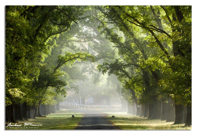
Gostwyck Chapel 2AM-001165
©Andrew McInnes

Gostwyck Chapel 2AM-001170
©Andrew McInnes
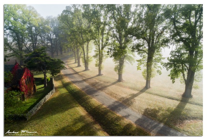
Gostwyck Chapel 2AM-000794
©Andrew McInnes
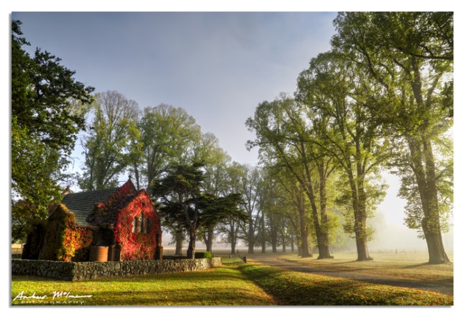
Gostwyck Chapel 2AM 6592-6593 stack
©Andrew McInnes
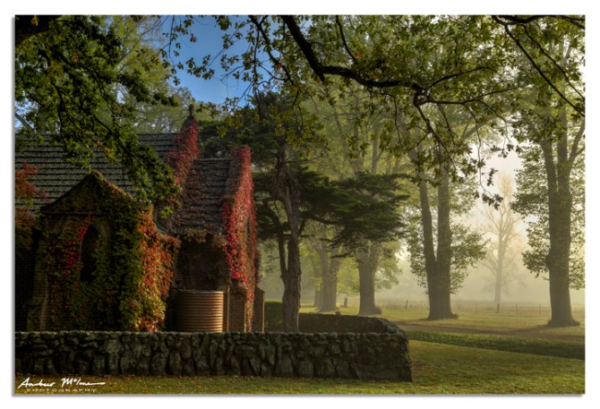
Gostwyck Chapel 2AM 6597-6599 stack
©Andrew McInnes
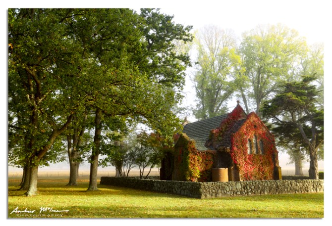
Gostwyck Chapel 2AM-006590
©Andrew McInnes
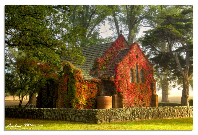
Gostwyck Chapel 2AM 6601-6602 stack
©Andrew McInnes

Gostwyck Chapel 2AM-001174
©Andrew McInnes

Gostwyck Chapel 2AM-006585
©Andrew McInnes
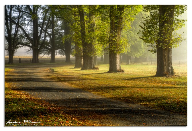
Gostwyck Chapel 2AM 6608-6610 stack
©Andrew McInnes
Cheers 🙂
A series of aerial (drone) images footy fields in southern Queensland.
The first series is of an AFL oval, the second series is of NRL ground.

AFL Oval 2AM-000825
©Andrew McInnes

AFL Oval 2AM-000831
©Andrew McInnes

AFL Oval 2AM-000837
©Andrew McInnes

AFL Oval 2AM-000838
©Andrew McInnes

AFL Oval 2AM-000819
©Andrew McInnes
Now the NRL field

NRL Ground 2AM-000859
©Andrew McInnes

NRL Ground 2AM-000849
©Andrew McInnes

NRL Ground 2AM-000854
©Andrew McInnes

NRL Ground 2AM-000856
©Andrew McInnes

NRL Ground 2AM-000865
©Andrew McInnes
Cheers 🙂
This photo essay shows a portion of the experience of the inaugural Eidsvold Cattle Drive from 2016. To watch a short video I made of the 2016 cattle drive, click here.
The second running of this cattle drive will be run 8th-14th April, 2018, and I will again be participating.

Eidsvold Charity Cattle Drive 2AM-002331
©Andrew McInnes
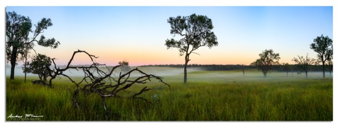
Eidsvold Charity Cattle Drive 2AM 1413-1415 Panorama
©Andrew McInnes

Eidsvold Charity Cattle Drive 2AM-001501
©Andrew McInnes

Eidsvold Charity Cattle Drive 2AM-000030
©Andrew McInnes

Eidsvold Charity Cattle Drive 2AM-005727
©Andrew McInnes

Eidsvold Charity Cattle Drive 2AM-006660
©Andrew McInnes

Eidsvold Charity Cattle Drive 2AM-002269
©Andrew McInnes

Eidsvold Charity Cattle Drive 2AM-001850
©Andrew McInnes

Eidsvold Charity Cattle Drive 2AM-002436
©Andrew McInnes

Eidsvold Charity Cattle Drive 2AM-00000211
©Andrew McInnes

Eidsvold Charity Cattle Drive 2AM-006572
©Andrew McInnes

Eidsvold Charity Cattle Drive 2AM-005588
©Andrew McInnes

Eidsvold Charity Cattle Drive 2AM-006331
©Andrew McInnes

Eidsvold Charity Cattle Drive 2AM-006640
©Andrew McInnes

Eidsvold Charity Cattle Drive 2AM-006707
©Andrew McInnes

Eidsvold Charity Cattle Drive 2AM-002333
©Andrew McInnes

Eidsvold Charity Cattle Drive 2AM-001597
©Andrew McInnes

Eidsvold Charity cattle Drive 2AM-001454
©Andrew McInnes

Eidsvold Charity cattle Drive 2AM-001417
©Andrew McInnes

Eidsvold Charity Cattle Drive 2AM-001627
©Andrew McInnes

Eidsvold Charity Cattle Drive 2AM-002087
©Andrew McInnes

Eidsvold Charity Cattle Drive 2AM-001654
©Andrew McInnes

Eidsvold Charity Cattle Drive 2AM-005436
©Andrew McInnes

Eidsvold Charity Cattle Drive 2AM-001794
©Andrew McInnes

Eidsvold Charity Cattle Drive 2AM-001820
©Andrew McInnes

Eidsvold Charity Cattle Drive 2AM-001548
©Andrew McInnes

Eidsvold Charity Cattle Drive 2AM-005522
©Andrew McInnes

Eidsvold Charity Cattle Drive 2AM-006344
©Andrew McInnes

Eidsvold Charity Cattle Drive 2AM-002329
©Andrew McInnes

Eidsvold Charity Cattle Drive 2AM-006067
©Andrew McInnes

Eidsvold Charity cattle Drive 2AM-001412
©Andrew McInnes

Eidsvold Charity Cattle Drive 2AM-006245
©Andrew McInnes

Eidsvold Charity Cattle Drive 2AM-002340
©Andrew McInnes

Eidsvold Charity Cattle Drive 2AM-001958
©Andrew McInnes

Eidsvold Charity Cattle Drive 2AM-006694
©Andrew McInnes
Cheers 🙂
A series of aerial (drone) images of the Bribie Island bridge and Pumicestone Passage, Queensland.

Bribie Island 2AM 0563-0565 stitch ©Andrew McInnes

Bribie Island 2AM-000535 ©Andrew McInnes

Bribie Island 2AM-000537 ©Andrew McInnes

Bribie Island 2AM-000538 ©Andrew McInnes

Bribie Island 2AM 0541-0556 stitch ©Andrew McInnes

Bribie Island 2AM 0557-0558 stitch ©Andrew McInnes

Bribie Island 2AM-000560 ©Andrew McInnes

Bribie Island 2AM-000561 ©Andrew McInnes
Cheers 🙂
This forest scene caught my attention on the hike up Mt. Ngungun, one of the glasshouse mountains on the Sunshine Coast of Queensland.
The 2.8 km round-trip hike is well worth including in your plans.
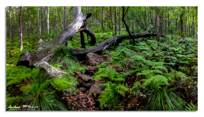
Mount Ngungun 2AM-001242
©2018 Andrew McInnes
Cheers 🙂
A pair of aerial images capturing some people resting between jet-ski rides and enjoying summer in Pumicestone Passage on the northern tip of Bribie Island, Queensland.

Bribie Island 2AM-000527
©Andrew McInnes

Bribie Island 2AM-000528
©Andrew McInnes
Cheers 🙂
Having recently relocated, this was my first real adventure out exploring the area for images; this is a 37-image (four rows) aerial panoramic stitch of Lake Kurwongbah, in Petrie/Kallangur, just a little north of Brisbane.
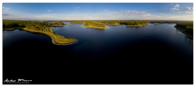
Lake Kurwongbah 2AM 0484-0520 stitch
©2018 Andrew McInnes
The following is a portion of the aerial panoramic stitch above.
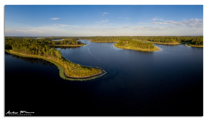
Lake Kurwongbah 2AM 0484-0520 stitch_crop
©2018 Andrew McInnes
Hope you enjoy. Cheers 
“Fraser” is the largest sand island in the world, is fascinating in its diversity, and absolutely stunning. I recently spent two nights on family vacation on the splendid Fraser Island, Queensland. As it was a family holiday, these were opportunistic photos and as such do not represent the vast diversity of habitats and scenery.
This is Lake McKenzie – a beautiful spot to have a freshwater swim.

Fraser Island 2AM-005282 ©Andrew McInnes
The view back as you approach Lake Wabby.

Fraser Island 2AM-005283 ©Andrew McInnes
The view up the sand dune from Lake Wabby.

Fraser Island 2AM 5293-5294 stitch ©Andrew McInnes
Sunrise ocean motion.

Fraser Island 2AM-005313 ©Andrew McInnes
Stranded jellyfish.

Fraser Island 2AM-005316 ©Andrew McInnes
Tempestuous sunrise.

Fraser Island 2AM 5342-5344 HDR ©Andrew McInnes
Ocean approachin’.

Fraser Island 2AM-005349 ©Andrew McInnes
Stranded jellyfish again.

Fraser Island 2AM-005353 ©Andrew McInnes
Beach Spinifex (Spinifex sericeus) in front of She-oaks (Allocasuarina and Casuarina spp.).

Fraser Island 2AM-005360 ©Andrew McInnes
Beach Spinifex (Spinifex sericeus).

Fraser Island 2AM-005361 ©Andrew McInnes
Beach Highway.

Fraser Island 2AM-005364 ©Andrew McInnes
Goats-foot Convolvulus (Ipomea pescaprae subsp. brasiliensis) and Beach Spinifex (Spinifex sericeus).

Fraser Island 2AM-005375 ©Andrew McInnes
Beach airstrip.

Fraser Island 2AM-005384 ©Andrew McInnes
North view from Indian Head.
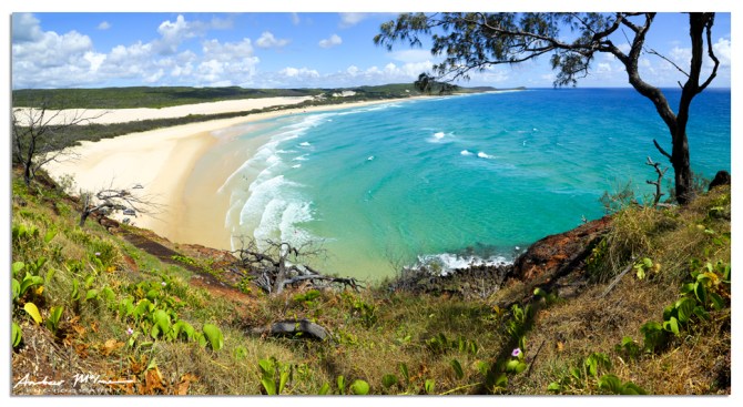
Fraser Island 2AM 5406-5413 stitch ©Andrew McInnes
South view from Indian Head.

Fraser Island 2AM-005417 ©Andrew McInnes
The beautiful Pacific Ocean as it meets the beach next to Indian Head.

Fraser Island 2AM-005419 ©Andrew McInnes
4WD’s from Indian Head.

Fraser Island 2AM-005420 ©Andrew McInnes
Contemplation on Indian Head.

Fraser Island 2AM-005425 ©Andrew McInnes
A very busy day at the famed Champagne Pools.
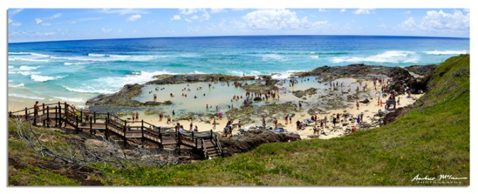
Fraser Island 2AM-5440-5443 stitch ©Andrew McInnes
Cruising down Eli Creek.

Fraser Island 2AM-005448
©Andrew McInnes
Cheers 🙂
Aerial views of some of the volcanic plugs (remnants of volcanic activity that occurred 25-27 million years ago), known as the Glasshouse Mountains on the Sunshine Coast of Queensland. Some of the mountains included in these images are Mount Beerwah, Mount Coonowrin (‘Crookneck’), Mount Ngungun, Mount Tibrogargan, and Mount Tunbubudla (‘The Twins’).
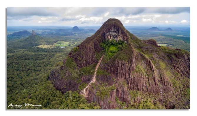
Mount Beerwah 2AM-000330 ©Andrew McInnes
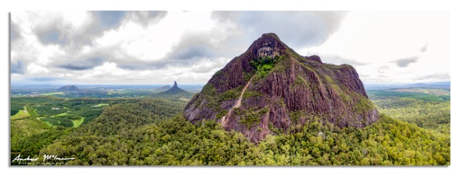
Mount Beerwah 2AM 0319-0324 stitch ©Andrew McInnes
Cheers 🙂
This post is of the spectacular Purling Brook (Purlingbrook) Falls and Goomoolahra Falls (also known as Bilbrough Falls) within Springbrook National Park – itself within the fabulous Scenic Rim region of Queensland.
These aerial images are taken with a drone.
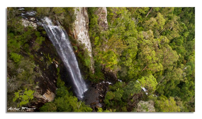
Goomoolahra Falls 2AM-000338 ©Andrew McInnes
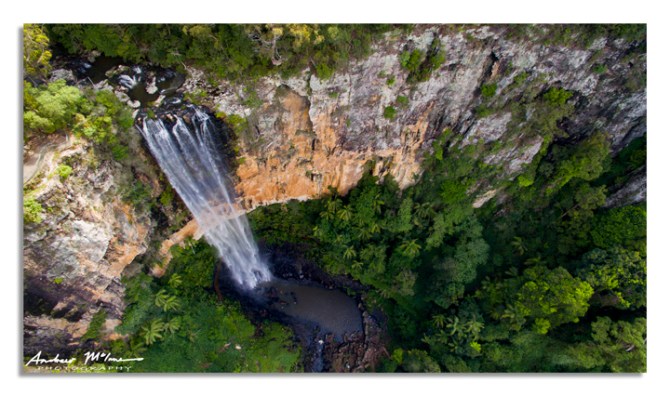
Purling Brook Falls 2AM-000369 ©Andrew McInnes
Cheers 🙂
With all the inclement weather we have been experiencing lately, I thought I’d check out the scene near Beechmont in the stunning Gold Coast hinterland.
This is a 3-row, 19-image panorama. Included in this scene is the Numinbah Valley, Ships Stern, Best of All Lookout, and Mt. Warning (Wollumbin) – the remnant plug of the ancient Tweed Shield Volcano.

Tweed Shield Volcano 2AM 9801-9820 stitch. ©Andrew McInnes
Cheers 🙂
I have just returned from a week of filming the Warwick Gold Cup Campdraft and the National Rodeo Finals, 2017. In the little free time I had, I snapped a couple of still images of two campdraft competitors.

Warwick Campdraft 2AM-009742. ©Andrew McInnes.

Warwick Campdraft 2AM-009748. ©Andrew McInnes.

Warwick Campdraft 2AM-009750. ©Andrew McInnes.

Warwick Campdraft 2AM-009759. ©Andrew McInnes.

Warwick Campdraft 2AM-009760. ©Andrew McInnes.
Cheers 🙂
These are images from the Caloundra Music Festival, 2017, including Xavier Rudd and his band performing on the main “Soul” stage at Kings Beach. Additionally, the lighthouse was fitted with a light show.

Caloundra Music Festival 2AM 0255-0257 stitch ©Andrew McInnes.

Caloundra Music Festival 2AM-000254 ©Andrew McInnes.

Caloundra Music Festival 2AM-005181 ©Andrew McInnes

Xavier Rudd 2AM-009715 ©Andrew McInnes.

Xavier Rudd 2AM-009701 ©Andrew McInnes.

Xavier Rudd 2AM-009702 ©Andrew McInnes

Xavier Rudd 2AM-009706 ©Andrew McInnes

Caloundra Music Festival 2AM-005183 ©Andrew McInnes

Caloundra Music Festival 2AM-005192 ©Andrew McInnes
Cheers 🙂
A series of aerial images capturing the sunset progression of a stunning winter ‘mackerel sky’ over Pumicestone Passage and Happy Valley, Caloundra.

Happy Valley 2AM 0183-0185 stitch ©Andrew McInnes.

Happy Valley 2AM-000186 ©Andrew McInnes.

Happy Valley 2AM 0205-0207 stitch ©Andrew McInnes.

Happy Valley 2AM 0208-0210 stitch ©Andrew McInnes.

Happy Valley 2AM 0222-0224 stitch ©Andrew McInnes.
Cheers 🙂
Morning surfers and a tumultuous dawn over Norries Head at Cabarita Beach, NSW.

Cabarita Beach 2AM-004698 ©Andrew McInnes. All Rights Reserved.

Cabarita Beach 2AM-004707 ©Andrew McInnes. All Rights Reserved.

Cabarita Beach 2AM-009072 ©Andrew McInnes. All Rights Reserved.

Cabarita Beach 2AM-004697 ©Andrew McInnes. All Rights Reserved.
Cheers 🙂
A serene winters day at Cabarita Beach on the Tweed Coast of NSW.
All images in this post are via UAV (drone). The first two images are multi-image panoramic stitches.

Cabarita Beach 2AM 000071-000073 stitch ©Andrew McInnes. All Rights Reserved.

Cabarita Beach 2AM 000095-000101 stitch ©Andrew McInnes. All Rights Reserved.

Cabarita Beach 2AM-000040 ©Andrew McInnes. All Rights Reserved.

Cabarita Beach 2AM-000045 ©Andrew McInnes. All Rights Reserved.

Cabarita Beach 2AM-000051 ©Andrew McInnes. All Rights Reserved.

Cabarita Beach 2AM-000089 ©Andrew McInnes. All Rights Reserved.

Cabarita Beach 2AM-000057 ©Andrew McInnes. All Rights Reserved.

Cabarita Beach 2AM-000070 ©Andrew McInnes. All Rights Reserved.

Cabarita Beach 2AM-000081 ©Andrew McInnes. All Rights Reserved.

Cabarita-Beach-2AM-000107 ©Andrew McInnes. All Rights Reserved.

Cabarita Beach 2AM-000110 ©Andrew McInnes. All Rights Reserved.

Cabarita Beach 2AM-000125 ©Andrew McInnes. All Rights Reserved.

Cabarita Beach 2AM-000129 ©Andrew McInnes. All Rights Reserved.

Cabarita Beach 2AM-000133 ©Andrew McInnes. All Rights Reserved.
Cheers 🙂
Sun streaming through The Chapel – Montville, on a slightly brisk winter’s dawn in the Sunshine Coast hinterland.

The Chapel-Montville 2AM-005120 ©Andrew McInnes. All Rights Reserved.
Cheers 🙂
Early morn’ and greeting the dawn with some cattle on the ‘moo ve’ near Maleny in the Sunshine Coast hinterland of Queensland.

Maleny Cattle 2AM-005104 ©Andrew McInnes. All Rights Reserved.
Cheers 🙂
This post is of the lush forest and 2,000 year old Antarctic Beech Trees (Nothofagus moorei) along the short trail to a lookout called Best of All Lookout within Springbrook National Park – itself within the fabulous Scenic Rim region of Queensland.
Conditions didn’t favour images from the lookout on my visit, but I shall return 😀

Springbrook National Park 2AM 4987-4988 HDR ©Andrew McInnes. All Rights Reserved.

Springbrook National Park 2AM-004970 ©Andrew McInnes. All Rights Reserved.

Springbrook National Park 2AM-004972 ©Andrew McInnes. All Rights Reserved.
The next two images show the bases of Antarctic beech trees – old and gnarly and amazing to view!

Springbrook National Park 2AM-004979 ©Andrew McInnes. All Rights Reserved.

Springbrook National Park 2AM-004984 ©Andrew McInnes. All Rights Reserved.

Springbrook National Park 2AM 5001-5003 HDR ©Andrew McInnes. All Rights Reserved.
“Selfie”

Springbrook National Park 2AM 4990_4993 HDR ©Andrew McInnes. All Rights Reserved.
Cheers 🙂
This post is of the spectacular Purling Brook (Purlingbrook) Falls and Goomoolahra Falls (also known as Bilbrough Falls) within Springbrook National Park – itself within the fabulous Scenic Rim region of Queensland.
What’s not to like about rainbows among waterfalls 😉
The first two images are taken with a drone: the first image is a two image vertical panorama, and the second is a single frame.

Goomoolahra Falls 2AM 0987-0998 stitch ©Andrew McInnes. All Rights Reserved.

Goomoolahra Falls 2AM- 001011 ©Andrew McInnes. All Rights Reserved.

Purlingbrook Falls 2AM-004961 ©Andrew McInnes. All Rights Reserved.
Cheers 🙂
This post is of the spectacular ‘Natural Bridge’ feature within Springbrook National Park – itself within the fabulous Scenic Rim region of Queensland. It requires a short and gentle scenic hike that is well worth taking.
At the beginning of the trail there is a junction: turn left and walk the circuit in a clockwise direction for the easiest hike (take steps down rather than ascend). Here is the junction point showing the “left” option…

Springbrook National Park 2AM 4911-4913 HDR ©Andrew McInnes. All Rights Reserved.

Springbrook National Park 2AM-004814 ©Andrew McInnes. All Rights Reserved.

Springbrook National Park 2AM 4824-4827 HDR ©Andrew McInnes. All Rights Reserved.

Springbrook National Park 2AM 4884-4885 HDR ©Andrew McInnes. All Rights Reserved.

Springbrook National Park 2AM 4889-4891 HDR ©Andrew McInnes. All Rights Reserved.

Springbrook National Park 2AM-004895 ©Andrew McInnes. All Rights Reserved.

Springbrook National Park 2AM 4899-4901 HDR ©Andrew McInnes. All Rights Reserved.

Springbrook NP 2AM 4834-4836 HDR ©Andrew McInnes. All Rights Reserved.

Springbrook NP 2AM 4839-4841 HDR ©Andrew McInnes. All Rights Reserved.

Springbrook NP 2AM 4862-4864 HDR ©Andrew McInnes. All Rights Reserved.
Cheers 🙂
A glorious Sunshine Coast winter’s day for Stage 2 of the Velothon Sunshine Coast, 2017.
Dawn at Moffat Beach, immediately prior to the days riding.

Moffat Beach 2AM-005007 ©Andrew McInnes. All Rights Reserved.
Ready to ride…

Sunshine Coast Velathon 2AM-005011 ©Andrew McInnes. All Rights Reserved.
Mount Tibrogargan backdrop.

Sunshine Coast Velathon 2AM-005062 ©Andrew McInnes. All Rights Reserved.
Mount Coonowrin (“Crookneck”) backdrop.

Sunshine Coast Velathon 2AM-005101 ©Andrew McInnes. All Rights Reserved.
Cheers 🙂
Surfers and wave refraction around Snapper Rocks into Rainbow Bay, Coolangatta, on the Gold Coast, Queensland.

Rainbow Bay 2AM-004773 ©Andrew McInnes. All Rights Reserved.

Rainbow Bay 2AM-009090 ©Andrew McInnes. All Rights Reserved.

Rainbow Bay 2AM-009092 ©Andrew McInnes. All Rights Reserved.

Rainbow Bay 2AM-009093 ©Andrew McInnes. All Rights Reserved.

Rainbow Bay 2AM-009096 ©Andrew McInnes. All Rights Reserved.

Rainbow Bay 2AM-009098 ©Andrew McInnes. All Rights Reserved.

Rainbow Bay 2AM-009099 ©Andrew McInnes. All Rights Reserved.

Rainbow Bay 2AM-009102 ©Andrew McInnes. All Rights Reserved.

Rainbow Bay 2AM-009109 ©Andrew McInnes. All Rights Reserved.

Rainbow Bay 2AM-009146 ©Andrew McInnes. All Rights Reserved.

Rainbow Bay 2AM-009152 ©Andrew McInnes. All Rights Reserved.

Rainbow Bay 2AM-009157 ©Andrew McInnes. All Rights Reserved.

Rainbow Bay 2AM-009160 ©Andrew McInnes. All Rights Reserved.

Rainbow Bay 2AM-009163 ©Andrew McInnes. All Rights Reserved.
Cheers 🙂
Large and interesting waves and reflected waves at Snapper Rocks, Coolangatta, on the Gold Coast, Queensland.

Snapper Rocks 2AM-009149 ©Andrew McInnes. All Rights Reserved.

Snapper Rocks 2AM-009115 ©Andrew McInnes. All Rights Reserved.

Snapper Rocks 2AM-009131 ©Andrew McInnes. All Rights Reserved.

Snapper Rocks 2AM-009150 ©Andrew McInnes. All Rights Reserved.
Cheers 🙂
The peace that is …
This is Curtis Falls and Cedar Creek in the Joalah Section of Tamborine National Park – itself within the fabulous Scenic Rim region of Queensland.

Curtis Falls 2AM 4724-4729-stitch. ©Andrew McInnes. All Rights Reserved.

Curtis Falls 2AM-004738 ©Andrew McInnes. All Rights Reserved.

Tamborine National Park 2AM-004709 ©Andrew McInnes. All Rights Reserved.

Tamborine National Park 2AM-004741 ©Andrew McInnes. All Rights Reserved.

Tamborine National Park 2AM-004746 ©Andrew McInnes. All Rights Reserved.
Cheers 🙂
There have been some lovely pastels at dusk lately. This wetlands scene is part of Ewen Maddock Dam, located along Steve Irwin Way on the Sunshine Coast of Queensland.

Ewen Maddock Dam 2AM 4579-4581_HDR
©Andrew McInnes. All Rights Reserved.
Cheers 🙂
Fresh locally grown pineapples on the Sunshine Coast, Queensland = DELICIOUS.
This series of photos (the first three) includes a pre-dusk image, then a blue-hour image including light-painting, then a startrail and light-painting image.

Pineapples 2AM-004190
©Andrew McInnes. All Rights Reserved.

Glasshouse Mountains 2AM 4405_16_18_HDR
©Andrew McInnes. All Rights Reserved.

Glasshouse Mountains 2AM 4418-4532_stack
©Andrew McInnes. All Rights Reserved.

Pineapple 2AM-008595
©Andrew McInnes. All Rights Reserved.

Pineapple 2AM-008599
©Andrew McInnes. All Rights Reserved.

Pineapple 2AM-008600
©Andrew McInnes. All Rights Reserved.

Pineapples 2AM-8607-8612_stack
©Andrew McInnes. All Rights Reserved.
Cheers 🙂
Recently we spent 3 nights in Hobart, Tasmania…
and on the last night the light did this 

Constitution Dock 2AM 2656-2658 Panorama ©Andrew McInnes. All Rights Reserved.

Constitution Dock 2AM 2684-2691 Panorama ©Andrew McInnes. All Rights Reserved.

Constitution Dock 2AM 2673-2675 Panorama ©Andrew McInnes. All Rights Reserved.

Constitution Dock 2AM 2680-2683 Panorama ©Andrew McInnes. All Rights Reserved.
Whilst in Hobart, a stroll among the charming Battery Point is highly recommended.
Here are some of my images from the area:

St George’s Anglican – Battery Point 2AM-002511 ©Andrew McInnes. All Rights Reserved.

Battery Point 2AM-002587 ©Andrew McInnes. All Rights Reserved.

Battery Point 2AM-002585 ©Andrew McInnes. All Rights Reserved.

Battery Point 2AM-002593 ©Andrew McInnes. All Rights Reserved.

Battery Point 2AM-002604 ©Andrew McInnes. All Rights Reserved.

Old Brick Wall 2AM-002588 ©Andrew McInnes. All Rights Reserved.

Window Shutters 2AM-002597 ©Andrew McInnes. All Rights Reserved.
Dusk settles over the historic Salamanca Place. Famed for its Salamanca Market, this area is a thriving market every Saturday morning, and is located next to the Hobart waterfront.

Salamanca Place 2AM 2706-2708 HDR ©Andrew McInnes. All Rights Reserved.

Leaves and Grass 2AM-002634 ©Andrew McInnes. All Rights Reserved.
Back to the waterfront…
The old…

Elizabeth Street Pier 2AM-002558 ©Andrew McInnes. All Rights Reserved.
The new…
The RV Investigator, operated by CSIRO, is the Marine National Facility for Australia, and is the only blue-water research vessel dedicated to marine research throughout Australia’s vast ocean territories.

RV Investigator 2AM-002552 ©Andrew McInnes. All Rights Reserved.

RV Investigator 2AM-002614 ©Andrew McInnes. All Rights Reserved.

Rock Lobster Pot 2AM-002545 ©Andrew McInnes. All Rights Reserved.

Tasmanian Museum and Art Gallery 2AM-002534 ©Andrew McInnes. All Rights Reserved.

Princes Wharf No1 2AM-002664 ©Andrew McInnes. All Rights Reserved.
Perhaps you will get a view of Sammy the Seal around Constitution Dock.

Sammy the Seal 2AM-006836 ©Andrew McInnes. All Rights Reserved.

Constitution Dock 2AM-002637 ©Andrew McInnes. All Rights Reserved.

Constitution Dock 2AM-002553 ©Andrew McInnes. All Rights Reserved.

Constitution Dock 2AM-002547 ©Andrew McInnes. All Rights Reserved.
Nestled against the waterfront, still in Battery Point, is the historic Princes Park, including the semaphore station (signal station) built in 1818.

Princes Park 2AM-002526 ©Andrew McInnes. All Rights Reserved.

Princes Park 2AM-002528 ©Andrew McInnes. All Rights Reserved.

Princes Park 2AM-002606 ©Andrew McInnes. All Rights Reserved.

Princes Park 2AM-002522 ©Andrew McInnes. All Rights Reserved.

Princes Park 2AM-002524 ©Andrew McInnes. All Rights Reserved.
I hope you enjoyed a little of the abundant variety available in and around Hobart.
Cheers, 🙂
Stunning, if fleeting, colour and drama at Coledale, in the Illawarra region of NSW.

Coledale 2AM-002791
©Andrew McInnes. All Rights Reserved.
Aerial (drone) photo of wave wrapping around rocks.

Coledale 2AM-000161
©Andrew McInnes. All Rights Reserved.
Freedom and playtime on the beach.

Coledale 2AM-007447
©Andrew McInnes. All Rights Reserved.

Coledale 2AM-007450
©Andrew McInnes. All Rights Reserved.
Another splendid summer day at Coledale Beach.

Coledale Beach 2AM-009728
©Andrew McInnes. All Rights Reserved.
Cheers 🙂
‘One Tree Hill’ in front of volcanic plugs (remnants of volcanic activity that occurred 25-27 million years ago) known as the Glasshouse Mountains, as seen along the Blackall Range Tourist Drive on the Sunshine Coast of Queensland.

One Tree Hill 2AM 7732-7739 Panorama ©Andrew McInnes. All Rights Reserved. This panorama is an eight-image stitch.

One Tree Hill 2AM-003245. ©Andrew McInnes. All Rights Reserved.

One Tree Hill 2AM 3312-3314 Panorama ©Andrew McInnes. All Rights Reserved. This panorama is an three-image stitch.
Cheers 🙂
A pair of Black Swans (Cygnus stratus) greet the dawn over Bribie Island and Pumicestone Passage, as seen from Golden Beach, Caloundra.

Golden Beach 2AM-003674 ©Andrew McInnes. All Rights Reserved.
Oh to be boating (and fishing) on a tranquil summer morning such as this.

Pumicestone Passage 2AM-008338 ©Andrew McInnes. All Rights Reserved.
Cheers, 🙂
After initially being occluded by clouds caressing the horizon, the supermoon shone over Kings Beach, Caloundra – on the superb Sunshine Coast of Queensland.

Kings Beach 2AM-003562 ©Andrew McInnes. All Rights Reserved.
Cheers, 🙂
’tis a tad dreary out today, so here’s to looking forward to more of this – Kings Beach, Caloundra, on the fabulous Sunshine Coast of QLD.

Kings Beach 2AM-003476 ©Andrew McInnes. All Rights Reserved.

Kings Beach 2AM-003477 ©Andrew McInnes. All Rights Reserved.
Cheers 🙂
Launching of the Metropolitan Caloundra Surf Lifesaving Club surf boat “Uncle Pete” for some training off the magnificent Kings Beach on the Sunshine Coast of Queensland.

Surf Boat 2AM-008519 ©Andrew McInnes. All Rights Reserved.

Surf Boat 2AM-008529 ©Andrew McInnes. All Rights Reserved.

Surf Boat 2AM-008537 ©Andrew McInnes. All Rights Reserved.

Surf Boat 2AM-008535 ©Andrew McInnes. All Rights Reserved.
Cheers 🙂
Colour abounded on a glorious Australia Day morning at the magnificent Kings Beach on the Sunshine Coast of Queensland.

Surf Rescue Boards 2AM-004067 ©Andrew McInnes. All Rights Reserved.

Surf Rescue Boards 2AM-008518 ©Andrew McInnes. All Rights Reserved.

Surf Rescue Boards 2AM-008523 ©Andrew McInnes. All Rights Reserved.
Cheers 🙂
A large, and very smoky bushfire in a pine forest near Bells Creek on Jan 31st, 2017. The water in these images is Pumicestone Passage, between Caloundra and Bribie Island.

Happy Valley 2AM-004095 ©Andrew McInnes. All Rights Reserved.

Happy Valley 2AM-004096 ©Andrew McInnes. All Rights Reserved.

Happy Valley 2AM-004100 ©Andrew McInnes. All Rights Reserved.
Progress as of Jan 27, 2017 on the construction and installation of the 15 megawatt Sunshine Coast Solar Farm at Valdora, with Mount Coolum in the background.

Sunshine Coast Solar Farm 2AM-000023 ©Andrew McInnes. All Rights Reserved.

Sunshine Coast Solar Farm 2AM-000018 ©Andrew McInnes. All Rights Reserved.
Cheers 🙂
The Kings Beach beachfront salt water pool, and water fountains (very popular with the children), as viewed from above during first-light at Caloundra – on the Sunshine Coast of Queensland.

Kings Beach 2AM-000446 ©Andrew McInnes. All Rights Reserved.

Kings Beach 2AM-000449 ©Andrew McInnes. All Rights Reserved.

Kings Beach 2AM-000457 ©Andrew McInnes. All Rights Reserved.
Cheers 🙂
Wattamolla Beach in Royal National Park, Sydney, NSW.

Wattamolla Beach 2AM 9321-9331_stack ©Andrew McInnes. All Rights Reserved.

Wattamolla Beach 2AM 9231-9243_stack ©Andrew McInnes. All Rights Reserved.

Wattamolla Beach 2AM 9205-9216_stack ©Andrew McInnes. All Rights Reserved.

Wattamolla Beach 2AM-002795 ©Andrew McInnes. All Rights Reserved.

Wattamolla Beach 2AM-009197 ©Andrew McInnes. All Rights Reserved.

Wattamolla Beach 2AM-009259 ©Andrew McInnes. All Rights Reserved.

Wattamolla Beach 2AM-009191 ©Andrew McInnes. All Rights Reserved.

Wattamolla Beach 2AM-009189 ©Andrew McInnes. All Rights Reserved.

Wattamolla Beach 2AM-009186 ©Andrew McInnes. All Rights Reserved.

Wattamolla Beach 2AM-009183 ©Andrew McInnes. All Rights Reserved.

Wattamolla Beach 2AM-009143 ©Andrew McInnes. All Rights Reserved.

Wattamolla Beach 2AM-009138 ©Andrew McInnes. All Rights Reserved.

Wattamolla Beach 2AM-009135 ©Andrew McInnes. All Rights Reserved.
Point Cartwright greets another glorious Sunshine Coast morning.

Point Cartwright 2AM-000075. ©Andrew McInnes. All Rights Reserved.
Cheers 🙂
These aerial (drone) scenes include Kings Beach, Wickham Headland, Shelly Beach, Moffat Headland, Pumicestone Passage, Bribie Island, the Glasshouse Mountains (in the background), and Caloundra – on the Sunshine Coast of Queensland.

Kings Beach 2AM 0424-0425 panorama stitch ©Andrew McInnes. All Rights Reserved.
The sea-sawdust slicks on the water surface in the following images is likely Trichodesmium sp. – a cyanobacteria (blue-green algae), and is also called whale food, sea scum and, incorrectly, whale sperm. Found in nutrient-poor tropical and subtropical ocean waters, Trichodesmium are ‘nitrogen fixers’- they can take nitrogen gas from the air and ‘fix’ it in a form that can be transferred through the food chain. This function is very important as Nitrogen is essential to life and while there is an abundance of it in the air (air is 78% Nitrogen, 21% Oxygen), most plants and animals can’t make use of it in that form.

Wickham Point 2AM 0434-0437 panorama stitch ©Andrew McInnes. All Rights Reserved.

Trichodesmium 2AM-000408 ©Andrew McInnes. All Rights Reserved.

Trichodesmium 2AM-000419 ©Andrew McInnes. All Rights Reserved.

Trichodesmium 2AM-000422 ©Andrew McInnes. All Rights Reserved.
Cheers 🙂
The serene Weeping Rock, near the town of Wentworth Falls in the Blue Mountains, NSW.

Weeping Rock 2AM 7474-7476 pano

Weeping Rock 2AM 7453-7455 stack
Aerial images of Windang and the mouth of Lake Illawarra, NSW.

Windang 2AM-000001

Windang 2AM-000002

Windang 2AM-000003

Windang 2AM-000004

Windang 2AM-000005
Cheers.
A short series of images from Wombarra in the Illawarra, NSW.

Wombarra Headland 2AM-009394

Wombarra Headland 2AM-002817

Wombarra Headland 2AM-009406

Wombarra Headland 2AM-009408

Wombarra Headland 2AM-002847

Wombarra Rock Pool 2AM-009706

Wombarra Rock Pool 2AM-009712

Wombarra Rock Pool 2AM-009725
Cheers.
A bushfire on Maddens Plains in the Illawarra Region of NSW.

Maddens Plains bushfire 2AM-003758

Maddens Plains bushfire 2AM-003544

Maddens Plains bushfire 2AM-003623

Maddens Plains bushfire 2AM-003887

Maddens Plains bushfire 2AM-003901

Maddens Plains bushfire 2AM-003909
Bare-nosed Wombats and Kookaburras at Bendeela Campground in Kangaroo Valley, NSW.

Bendeela Campground 2AM 1468-1469 pano

Bare-nosed wombat 2AM-001370

Bare-nosed wombat 2AM-001412

Bare-nosed wombat 2AM-001393

Bendeela Campground 2AM-001458

Laughing Kookaburra 2AM-001384

Laughing Kookaburra 2AM-001387

Laughing Kookaburra 2AM-00139
An assortment of subjects from the intertidal zone at Pearl Beach, NSW.

Pearl Beach 2AM-008782

Pearl Beach 2AM-008788

Pearl Beach 2AM-008793

Pearl Beach 2AM-008798

Pearl Beach 2AM-008803

Pearl Beach 2AM-008816

Pearl Beach 2AM-008830

Pearl Beach 2AM-008835

Pearl Beach 2AM-008844

Pearl Beach 2AM-008849

Pearl Beach 2AM-008857

Pearl Beach 2AM-008864

Pearl Beach 2AM-008871
We have experienced a few dramatic early-summer thunderstorms at our new home over the last few weeks. These scenes are from Kings Beach and Happy Valley, at Caloundra – on the Sunshine Coast of Queensland. Some show storms building, others in mid-action, and others of the retreat.

Kings Beach 2AM 3781-3786 stitch

Caloundra 2AM-003731

Caloundra 2AM-003541

Caloundra 2AM-003548

Caloundra 2AM-003700

Caloundra 2AM-003701

Caloundra 2AM-003712

Kings Beach 2AM-003643

Kings Beach 2AM-003646

Kings Beach 2AM-003647
Aerial and terrestrial images of Cabarita Beach, Norries Head, Hastings Point, and Cudgera Creek – on the Tweed Coast of NSW.

Cabarita Beach 2AM-000274

Fish 2AM-007879
Hastings Point, NSW – where Cudgera Creek enters the sea after it’s sinuous meander.

Hastings Point 2AM-000277

Hastings Point 2AM-000278

Hastings Point 2AM-000281

Hastings Point 2AM-000289

Hastings Point 2AM-000292

Humpback Sunrise 2AM-007774

Maggies Beach 2AM 3413-3414 Panorama

Norries Head 2AM-000265

Norries Head 2AM 262-263 Panorama

Norries Head 2AM-000266

Norries Head 2AM-000270

Norries Head 2AM-000271

Norries Head 2AM-007865

Norries Head 2AM-007869

Cabarita Beach 2AM-008398

Hastings Point 2AM-002294

Hastings Point 2AM-008417

Hastings Point 2AM-008447

Norries Head 2AM-002279

Norries Head 2AM-008392
Rain caresses the skirts of Grose Valley in the Blue Mountains – near Blackheath, NSW, plus a portion of the floral diversity at the beautiful Campbell Rhododendron Gardens in Blackheath, NSW.

Blue Mountains 2AM-006879

Blue Mountains 2AM-006899

Blue Mountains 2AM 6914-6915 Panorama

Blue Mountains 2AM 6929-6935 Panorama

Blue Mountains 2AM-006938

Blue Mountains 2AM-006942

Campbell Rhododendron Gardens 2AM 6831-6832 Panorama

Campbell Rhododendron Gardens 2AM 6845-6847 Panorama
Bare Island, on Botany Bay = history.

Bare Island 2AM-007595

La Perouse Customs Tower 2AM-007605
The impressive Belmore Falls, in good flow. These falls are in Morton National Park, very near the town of Robertson in the Southern Highlands region of NSW.
The Belmore Falls is a plunge waterfall with three drops on the Barrengarry Creek in the Southern Highlands and Illawarra regions of New South Wales.

Belmore Falls 2AM-000097

Belmore Falls 2am-003088

Hindmarsh Lookout 2AM-003055

Hindmarsh Lookout 2AM-003066

Hindmarsh Lookout 2AM-003072
Some images from Austinmer in the northern Illawarra area of New South Wales, Australia.

Austinmer 2AM-000069
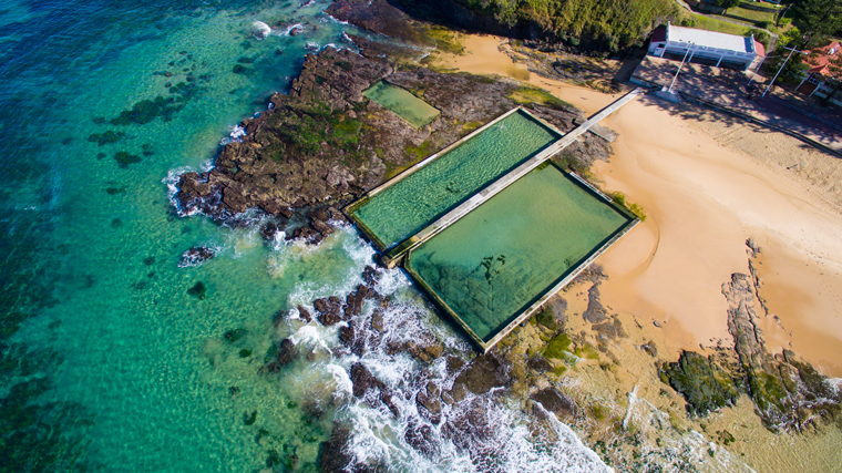
Austinmer 2AM-000076
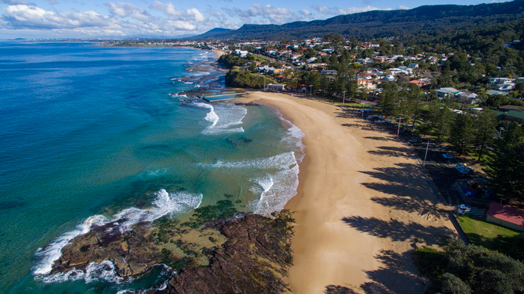
Austinmer 2AM-000072

Austinmer Sunrise 2am-003460

Austinmer Surfers 2am-009661
Cheers 🙂
The 360 degree view afforded from the top of Mt. Ngungun is fascinating – the 2.8 km (return) hike up is well worth including in your plans.
These are some of the volcanic plugs (remnants of volcanic activity that occurred 25-27 million years ago), known as the Glasshouse Mountains on the Sunshine Coast of Queensland. These two are, from nearest to furthest, Mount Coonowrin and Mount Beerwah, as seen from Mount Ngungun.

Glasshouse Mountains 2AM-003979. ©Andrew McInnes. All Rights Reserved.

Glasshouse Mountains 2AM-004006. ©Andrew McInnes. All Rights Reserved.

Glasshouse Mountains 2am 3992-3995_stitch ©Andrew McInnes. All Rights Reserved.

Glasshouse Mountains 2AM-004003. ©Andrew McInnes. All Rights Reserved.

Glasshouse Mountains 2AM-004009. ©Andrew McInnes. All Rights Reserved.

Glasshouse Mountains 2AM-004013. ©Andrew McInnes. All Rights Reserved.

Glasshouse Mountains 2AM-004021. ©Andrew McInnes. All Rights Reserved.
Cheers.
On a recent trip I was quite relieved when I finally sighted this sign – I was beginning to wonder where I was going to rest/leave my trusty kangaroo-steed, having been travelling for several hours  😉
Perhaps my recollections are failing me, but I thought these were much more abundant when I was in school – perhaps everyone is using roo-ber?

Roo Parking Sign 2am-003347
Full moon rising over Bulcock Beach and Happy Valley, Caloundra – on the Sunshine Coast region of Queensland.

Caloundra 2AM-003971. ©Andrew McInnes. All Rights Reserved.
The Caloundra area and Pumicestone Passage on the Sunshine Coast offer numerous peaceful scenes. This particular one was enjoyed with a picnic dinner.

Golden Beach 2AM-003962 ©Andrew McInnes. All Rights Reserved.
A fiery sunset over volcanic plugs (remnants of volcanic activity that occurred 25-27 million years ago), known as the Glasshouse Mountains on the Sunshine Coast of Queensland. At just over an hour from Brisbane, these hills are well worth a visit.
This is a 12 image panorama stack.

Glasshouse Mountains 2AM 3904-3915_Pano
©Andrew McInnes. All Rights Reserved.
This is an additional placeholder post. Click the Edit link to modify or delete it, or start a new post. If you like, use this post to tell readers why you started this blog and what you plan to do with it.
A recent overnight visit to Iluka and we were presented with a considerable storm system and some fantastic, and rapidly changing, light.

Iluka 2AM-003104 ©Andrew McInnes. All Rights Reserved.

Iluka 2AM-003105 ©Andrew McInnes. All Rights Reserved.

Iluka 2AM-003107 ©Andrew McInnes. All Rights Reserved.

Iluka 2AM-003114 ©Andrew McInnes. All Rights Reserved.

Iluka 2AM-003127 ©Andrew McInnes. All Rights Reserved.

Iluka 2AM-003118 ©Andrew McInnes. All Rights Reserved.

Iluka 2AM-003147 ©Andrew McInnes. All Rights Reserved.

Iluka 2AM-003152 ©Andrew McInnes. All Rights Reserved.
Cheers 🙂
A very powerful weather system is impacting a considerable portion of the east coast of Australia this weekend. Here is the Bureau of Meteorology link and the ABC link.
Here are three images: the first is an aerial image (drone) at Scarborough showing clear weather conditions before the system began to directly impact this section of the Illawarra Coast, and the remaining two images from Bald Hill show the first wave of weather making its way to the coast.

Scarborough-2AM-0014. ©Andrew McInnes. All Rights Reserved.

Bald Hill 2AM 2771-2772 Panorama. ©Andrew McInnes. All Rights Reserved.

Bald Hill 2AM-002769. ©Andrew McInnes. All Rights Reserved.
Here’s to hoping the farmers and graziers get good rain where needed.
‘nuf said?
The Liverpool Plains is a prime food and fibre producing area that is under imminent threat from several coal mines – at least one of which, the Shenhua Watermark mine, is foreign-owned (Chinese). These companies seek to rape and scar the land, deplete and contaminate aquifers, then pack up and leave once the destruction is no longer financially viable. Never mind that there are farmers, you know, living breathing hard-working people, with families and dreams, enduring incredible stress as they seek to remain being outstanding stewards of the land they sweat for. How and why our political “representatives” allow this is beyond me – I suppose it goes along with their belief in continued economic growth year on year. Well, let’s inform them that exponential growth is unattainable and to seek it is ignorantly irresponsible (but I guess it is politically astute?).
I am not against mining, per se, however I do have issues with “the commons” being over-extracted for the profits of a few whilst the landholder has little recompense for the invasion, and the people of this nation see very little direct financial benefits. As another roadside sign in the area states: “Wrong mine, wrong place.”
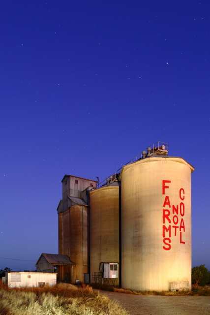
A pre-dawn light painting at Breeza, on the Liverpool Plains, NSW. Breeza 2AM-001230 ©Andrew McInnes.

Silos at dusk. Breeza 2AM-001216 ©Andrew McInnes.
I hope you enjoyed these images.
Cheers 🙂

