Posting #12 of my road trip from Fremantle to Kununurra, Western Australia.

The 12th and final posting of my trip up to Kununurra and back!
This is a small collection of images from a brief detour to visit the wonderful Tunnel Creek National Park.

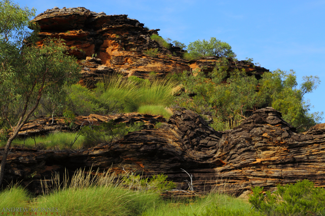
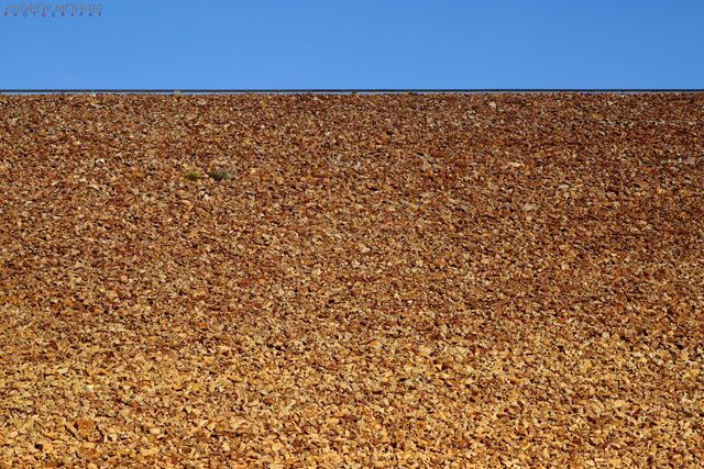
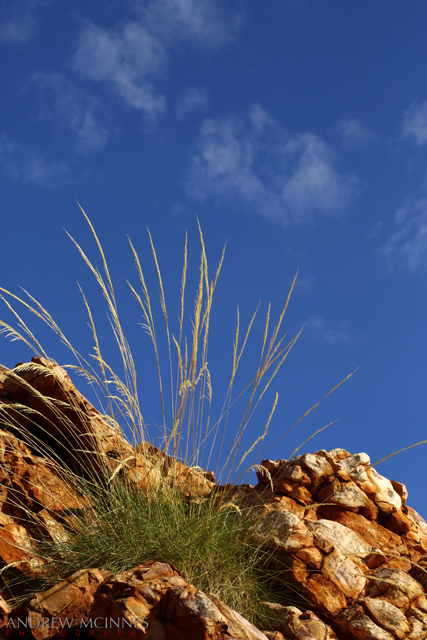
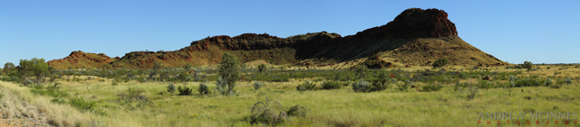
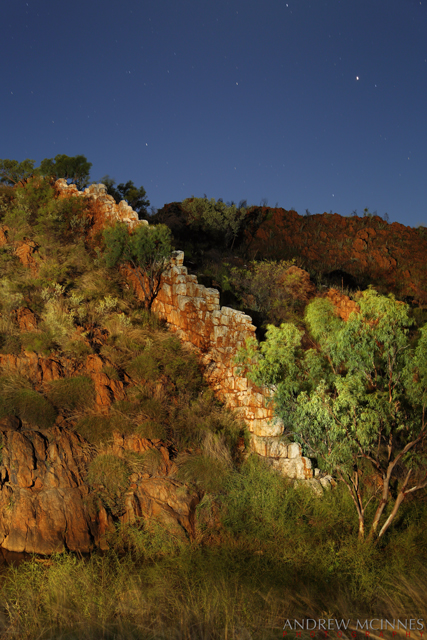
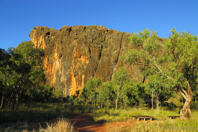
The view as you near Tunnel Creek along Leopold Downs Road. This is part of the Napier Range: Devonian reef from 350 – 375 million years ago.

Devonian Reef 2AM-003686. ©2014 Andrew McInnes.

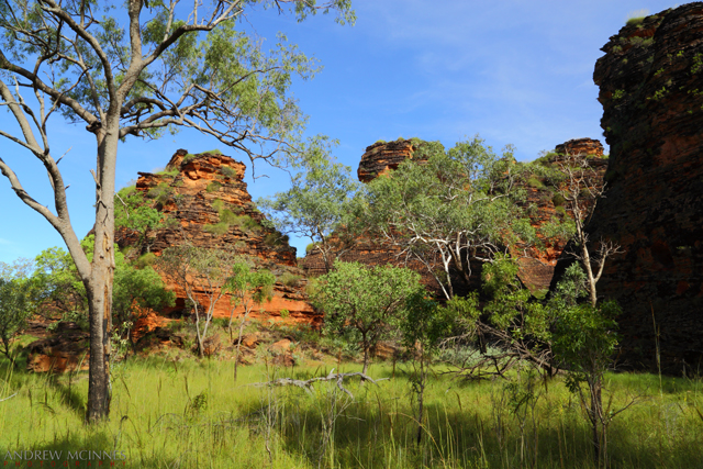
Devonian Reef 2AM-003682. ©2014 Andrew McInnes.

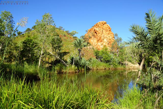
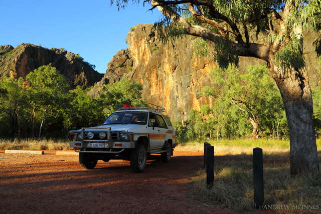
Underneath the bluff in the following picture is ‘Tunnel Creek’ – a 750 meter erosion tunnel through the Napier Range, eroded by a creek. The tunnel is purported to be the oldest cave system in Western Australia!

Tunnel-Creek-National-Park-2AM-003691

Tunnel Creek National Park 2AM-003691. ©2014 Andrew McInnes.

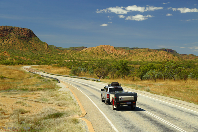
This is a day-use park only; this is my trusty 1984 Toyota Hilux in the parking area – only a very short hike to the cave entrance.

Tunnel Creek National Park 2AM-003689. ©2014 Andrew McInnes.

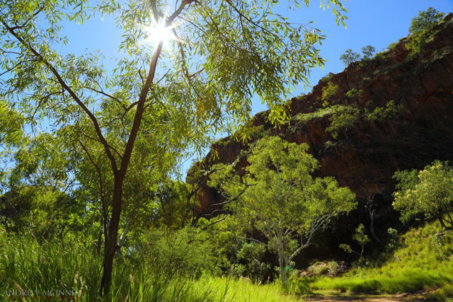
Along the trail to the cave entrance…

Tunnel Creek National Park 2AM-003700. ©2014 Andrew McInnes.

Inside Tunnel Creek, looking back toward the entrance…

Tunnel Creek National Park 2AM-003765. ©2014 Andrew McInnes.

Looking deeper into Tunnel Creek – follow it to the right 😉

Tunnel Creek National Park 2AM-003772. ©2014 Andrew McInnes.

Tunnel Creek National Park 2AM-003774. ©2014 Andrew McInnes.


That’s it for now. Until next time, thanks for visiting.


Posting #8 of my road trip from Fremantle to Kununurra, Western Australia.

Mirima/Hidden Valley National Park – Kununurra, Western Australia.
Bungle Bungles in miniature – located just minutes from Kununurra, Mirima/Hidden Valley is a small park with sandstone ranges, cliffs and valleys, similar in appearance (and formed by similar processes) to parts of the Bungle Bungles (Purnululu National Park). The 350 million year old sandstone features within the park are subject to some striking colour changes due to sunlight variances.

Here is the ‘mini Bungle Bungles’ (a portion of Mirima/Hidden Valley), viewed from a helicopter, including the town of Kununurra, Lily Creek, Indian Sandalwood plantations, and a portion of the surrounding ranges.

Kununurra-and-Mini-Bungle-Bungles-2AM-003518

Kununurra and Mini Bungle Bungles 2AM-003518 © 2014 Andrew McInnes.

Hidden-Valley-National-Park-2AM-003519

Hidden Valley National Park 2AM-003519 © 2014 Andrew McInnes.

Hidden-Valley-National-Park-2AM-003533

Hidden-Valley-National-Park-2AM-003533. © 2014 Andrew McInnes.


Okay, back on terra firma – time for a wander through Hidden Valley…

Hidden-Valley-National-Park-2AM-003277

Hidden Valley National Park 2AM-003277. © 2014 Andrew McInnes.

Hidden-Valley-National-Park-2AM-003262

Hidden Valley National Park 2AM-003262. © 2014 Andrew McInnes.

Hidden-Valley-National-Park-2AM-003180

Hidden Valley National Park 2AM-003180. © 2014 Andrew McInnes.

Hidden-Valley-National-Park-2AM-003224

Hidden Valley National Park 2AM-003224. © 2014 Andrew McInnes.

Hidden-Valley-National-Park-2AM-003281

Hidden Valley National Park 2AM-003281. © 2014 Andrew McInnes.

Hidden-Valley-National-Park-2AM-003284

Hidden Valley National Park 2AM-003284. © 2014 Andrew McInnes.

Hidden-Valley-National-Park-2AM-003200

Hidden Valley National Park 2AM-003200. © 2014 Andrew McInnes.

Hidden-Valley-National-Park-2AM-003206_crop

Hidden Valley National Park 2AM-003206. © 2014 Andrew McInnes.

Hidden-Valley-National-Park-2AM-003249

Hidden Valley National Park 2AM-003249. © 2014 Andrew McInnes.

Hidden-Valley-National-Park-2AM-003259

Hidden Valley National Park 2AM-003259. © 2014 Andrew McInnes.

Hidden-Valley-National-Park-2AM-003273

Hidden Valley National Park 2AM-003273. © 2014 Andrew McInnes.

Posting #7 of my road trip from Fremantle to Kununurra, Western Australia.

Ah, I arrived at my destination – Kununurra – after 9 days of driving and bush camping. Here are some images around the greater Kununurra area from the first day or so.

Not far short of Kununurra, and the scenery, topography, and geology changes (after leaving Halls Creek).

Highway-and-Bluff-2AM-003678

Great Northern Highway 2AM-003678. © 2014 Andrew McInnes.

Assorted roadside grasses…

Grass-2AM-002958

Grass 2AM-002958. © 2014 Andrew McInnes.

Grass-2AM-002960

Grass 2AM-002960. © 2014 Andrew McInnes.

Lake-Argyle-2AM-003141

Grass 2AM-003141. © 2014 Andrew McInnes.

The fishing is fantastic in the Kimberley; this is a 1.14 meter Barramundi (released immediately after photo) caught on the lower Ord River.

Duane-and-Barramundi-2AM_3066_b

Fisherman and Barramundi 2AM-3066. © 2014 Andrew McInnes.

The ubiquitous estaurine crocodiles (“Saltwater Crocodile”) necessitate care around the water.

Saltwater-Crocodile-2AM-004748---Copy

Saltwater Crocodile 2AM-004748. © 2014 Andrew McInnes.

Saltwater-Crocodile-2AM-004757

Saltwater Crocodile 2AM-004757. © 2014 Andrew McInnes.

Saltwater-Crocodile-2AM-004771

Saltwater Crocodile 2AM-004771. © 2014 Andrew McInnes.


Iconic Kimberley vistas…
If you have watched the movie “Australia” then you may recognise this geologic feature, known as ‘House Roof Hill’ – it is the backdrop to the fictional “Faraway Downs” homestead.
This image was captured very early on another glorious Kimberley morning.

House-Roof-Hill-2AM-003047

House Roof Hill 2AM-003047. © 2014 Andrew McInnes.

The next image is “False House Roof Hill” – neighboring bluffs along the Ord River.

False-House-Roof-Hill-2AM-003013

False House Roof Hill 2AM-003013. © 2014 Andrew McInnes.

The April 2014 Lunar Eclipse occurred whilst I was in this area. The following image captures part of this eclipse over a Kimberley range.

Lunar-Eclipse-2AM-004793

Lunar Eclipse 2AM-004793. © 2014 Andrew McInnes.

Lake Argyle is Australia’s largest artificial lake (by volume). It is part of the Ord River Irrigation Scheme and is a sight to behold. Unfortunately these “roadside” images are all I managed to capture of this vast and beautiful feature – I must return and spend time above and on the lake!

Lake-Argyle-2AM-3131-3134-pano

Lake Argyle 2AM_3131-3134 panoramic. © 2014 Andrew McInnes.

An alternate view of the Ord River Dam – construction was completed in 1971.

Lake-Argyle-2AM-003126

Lake Argyle 2AM-003126. © 2014 Andrew McInnes.

Grass in seed along the dam wall – beautiful April conditions.

Lake-Argyle-2AM-003137

Lake Argyle 2AM-003137. © 2014 Andrew McInnes.


Posting #6 of my road trip from Fremantle to Kununurra, Western Australia.

Into the Kimberley Region…

Highway-Outcrop-2AM-2808-09_2811-13_2815-panoIf you plan on being near Halls Creek I thoroughly recommend taking the time to explore along Duncan Road…

China Wall – a quartz outcrop.

China-Wall-2AM-002820

China Wall 2AM-002820. © 2014 Andrew McInnes.

A light painting of China Wall.

China-Wall-2AM-002895

China Wall 2AM-002895. © 2014 Andrew McInnes.

The very refreshing, and aptly named, Palm Springs.

Palm-Springs-2AM-002836

Palm Springs 2AM-002836. © 2014 Andrew McInnes.

A ‘selfie’ in Palm Springs – lovely safe place for a dip.

Palm-Springs-2AM-002832

Palm Springs 2AM-002832. © 2014 Andrew McInnes.

Mulla mulla wildflowers along Duncan Road, Halls Creek.

Mulla-Mulla-Flowers-2AM-002861

Mulla Mulla Flowers 2AM-002861. © 2014 Andrew McInnes.

Mulla-Mulla-Flowers-2AM-002823

Mulla Mulla Flowers 2AM-002823. © 2014 Andrew McInnes.

One of the water crossings along Duncan Road, Halls Creek.

Duncan-Road-2AM-002841

Duncan Road 2AM-002841. © 2014 Andrew McInnes.

Sawtooth Gorge is a beautiful and secluded camping/visiting area- well worth the short bumpy dirt road in.

Sawtooth-Gorge-2AM-002827

Sawtooth Gorge 2AM-002827. © 2014 Andrew McInnes.

An iconic avian species – the Wedge-tailed Eagle – perched on a termite mound outside Fitzroy Crossing.

Wedge-tailed-Eagle-2AM-004698

Wedge-tailed Eagle 2AM-004698. © 2014 Andrew McInnes.

An iconic boab tree at dusk on the Great Northern Highway – a common Kimberley vista.

Boab-Sunset-2AM-2791-and-2793_pano2

Boab Sunset 2AM 2791 and 2793_pano2. © 2014 Andrew McInnes.