This is a multi-image panorama at low tide of the 1770 Camping Ground, Queensland.

Seventeen Seventy 2AM 9354-9378 stitch
©Andrew McInnes
Cheers 🙂
This is a multi-image panorama at low tide of the 1770 Camping Ground, Queensland.
Seventeen Seventy 2AM 9354-9378 stitch
©Andrew McInnes
Cheers 🙂
Aerial images of Round Hill Creek, at the Town of 1770, Queensland.
Seventeen Seventy 2AM 0769-0778 stitch
©Andrew McInnes
Seventeen Seventy 2AM-000742
©Andrew McInnes
Seventeen Seventy 2AM-000743
©Andrew McInnes
Seventeen Seventy 2AM-000744
©Andrew McInnes
Seventeen Seventy 2AM-000745
©Andrew McInnes
Seventeen Seventy 2AM-000766
©Andrew McInnes
Seventeen Seventy 2AM-000786
©Andrew McInnes
Seventeen Seventy 2AM-0703-0715 stitch
©Andrew McInnes
Seventeen Seventy 2AM 0736-0740 stitch
©Andrew McInnes
Seventeen Seventy 2AM-0746-0748 stitch
©Andrew McInnes
Seventeen Seventy 2AM-0749-0756 stitch
©Andrew McInnes
Seventeen Seventy 2AM-0757-0765 stitch
©Andrew McInnes
Seventeen Seventy 2AM-000735
©Andrew McInnes
Cheers 🙂
Boats at rest during a tranquil sunset on Round Hill Creek – the Town of 1770, Queensland.
Seventeen Seventy 2AM-009255 ©Andrew McInnes
Seventeen Seventy 2AM-009260 ©Andrew McInnes
Seventeen Seventy 2AM-009401 ©Andrew McInnes
Seventeen Seventy 2AM-009545 ©Andrew McInnes
Seventeen Seventy 2AM-009552 ©Andrew McInnes
Seventeen Seventy 2AM-009556 ©Andrew McInnes
Seventeen Seventy 2AM-009571 ©Andrew McInnes
Cheers 🙂
A visit with an old friend afforded me a little spare time to capture a little series of aerial images around Noosa, Queensland.
Cheers 🙂
A series of images of Double Island Point, Carlo Sand Blow, and Carlo Point during an express visit with friends who live in this beautiful area – Rainbow Beach, Queensland.
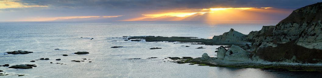
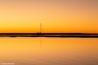
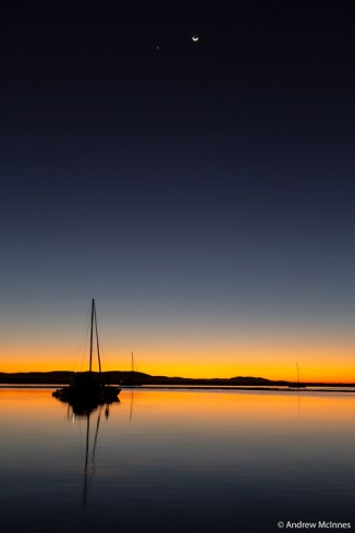
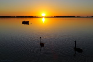
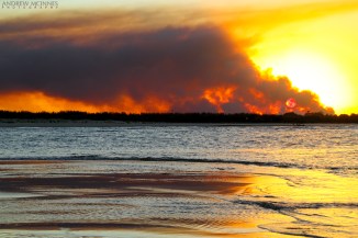
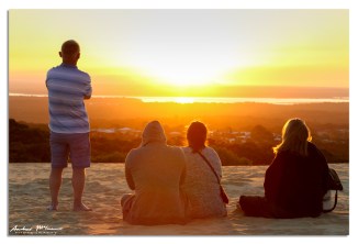
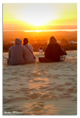
Sunset viewed from Carlo Sandblow.
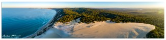
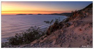
Early morning and sunrise at Carlo Sand Blow.
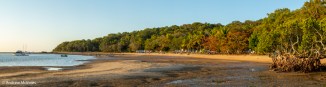
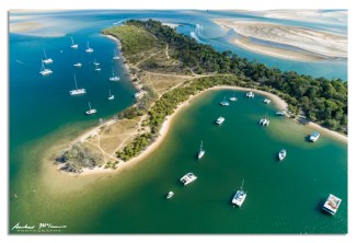
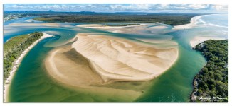
Double Island Point.
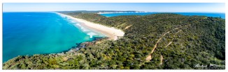
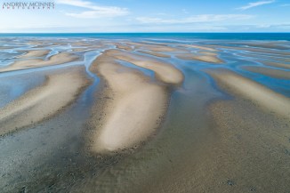
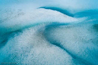
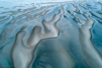
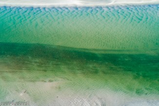
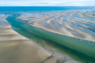
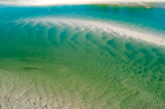
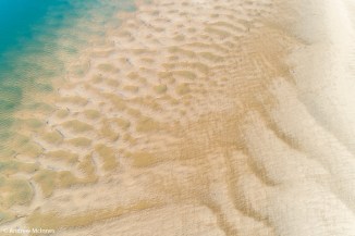
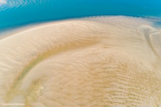
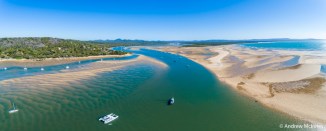
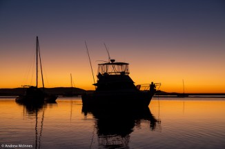
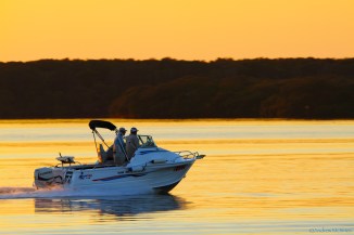
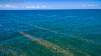
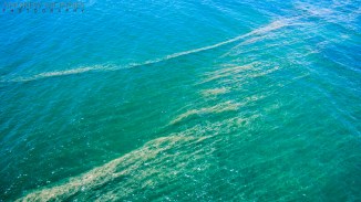
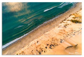
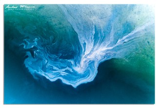
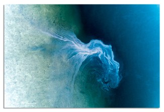
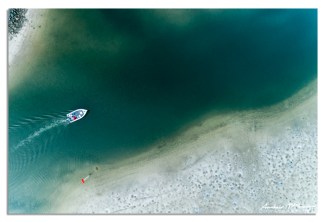
Carlo Point, on the estuary side of Rainbow Beach.
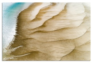
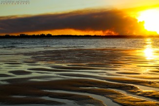
Estuarine leachate funnelling off tidal flats during ebb tide…
Cheers 🙂
A series of aerial (drone) images of the Bribie Island bridge and Pumicestone Passage, Queensland.
Cheers 🙂
A pair of Black Swans (Cygnus stratus) greet the dawn over Bribie Island and Pumicestone Passage, as seen from Golden Beach, Caloundra.
Oh to be boating (and fishing) on a tranquil summer morning such as this.
Cheers, 🙂
A large, and very smoky bushfire in a pine forest near Bells Creek on Jan 31st, 2017. The water in these images is Pumicestone Passage, between Caloundra and Bribie Island.
These aerial (drone) scenes include Kings Beach, Wickham Headland, Shelly Beach, Moffat Headland, Pumicestone Passage, Bribie Island, the Glasshouse Mountains (in the background), and Caloundra – on the Sunshine Coast of Queensland.
The sea-sawdust slicks on the water surface in the following images is likely Trichodesmium sp. – a cyanobacteria (blue-green algae), and is also called whale food, sea scum and, incorrectly, whale sperm. Found in nutrient-poor tropical and subtropical ocean waters, Trichodesmium are ‘nitrogen fixers’- they can take nitrogen gas from the air and ‘fix’ it in a form that can be transferred through the food chain. This function is very important as Nitrogen is essential to life and while there is an abundance of it in the air (air is 78% Nitrogen, 21% Oxygen), most plants and animals can’t make use of it in that form.
Cheers 🙂
We have experienced a few dramatic early-summer thunderstorms at our new home over the last few weeks. These scenes are from Kings Beach and Happy Valley, at Caloundra – on the Sunshine Coast of Queensland. Some show storms building, others in mid-action, and others of the retreat.
Caloundra 2AM-003731