Posting #10 of my road trip from Fremantle to Kununurra, Western Australia.

A collection of images from Lake Kununurra, Lily Creek Lagoon, Ivanhoe Crossing, and the iconic Cockburn Ranges – all proximal to Kununurra, Western Australia.

A delightful boat ride up Lake Kununurra – the dog enjoyed the trip, especially the breeze in its face.

Lake Kununurra 2AM-003377. © 2014 Andrew McInnes.

Lake Kununurra 2AM-003403. © 2014 Andrew McInnes.

Lake Kununurra 2AM-003421. © 2014 Andrew McInnes.

Lake-Kununurra-2AM-003422

Lake Kununurra 2AM-003422. © 2014 Andrew McInnes.

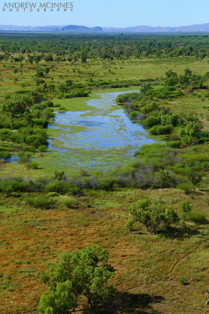
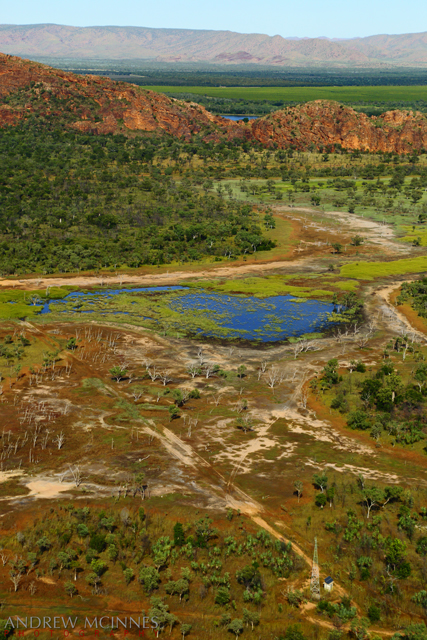
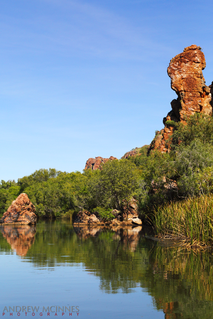
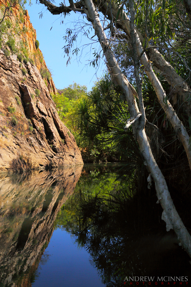
A couple of the numerous and delightful inlets along the way.

Lake Kununurra 2AM-003425. © 2014 Andrew McInnes.

Lake Kununurra 2AM-003435. © 2014 Andrew McInnes.

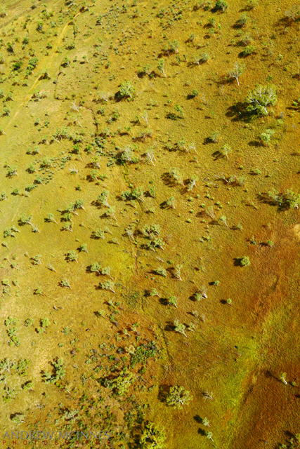
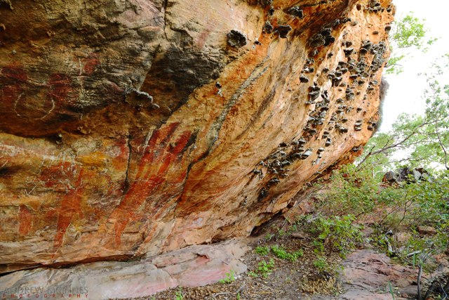
The exposed geology is fascinating and stunning.

Lake Kununurra 2AM-003437. © 2014 Andrew McInnes.

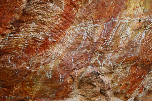
The Kimberley region has numerous sites with indigenous rock art; this particular location is very near to Kununurra.

Aboriginal Rock Art 2AM-003475. © 2014 Andrew McInnes.

Aboriginal Rock Art 2AM-003480. © 2014 Andrew McInnes.

Aboriginal Rock Art 2AM-003483. © 2014 Andrew McInnes.

Aboriginal Rock Art 2AM-003485. © 2014 Andrew McInnes.

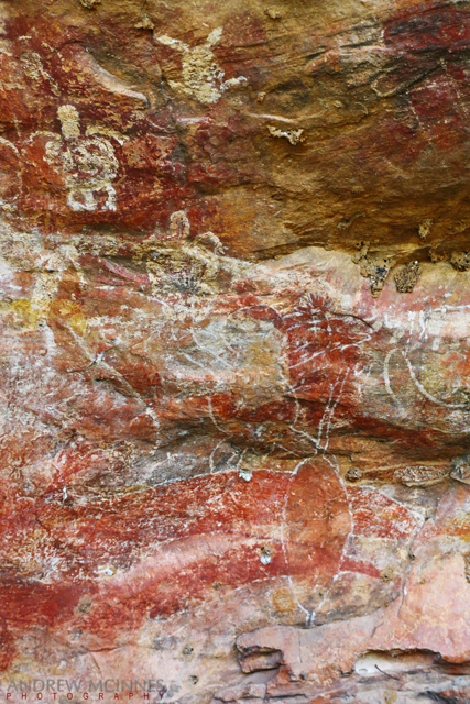
Aboriginal Rock Art 2AM-003487. © 2014 Andrew McInnes.

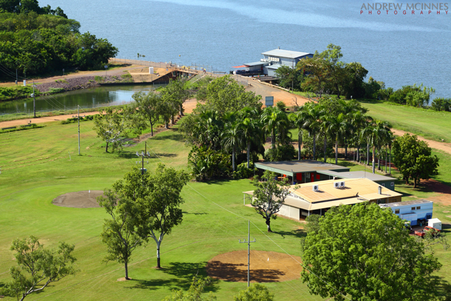
The view from the boat ramp on Lily Creek where we began and concluded this trip up Lake Kununurra.

Lily Creek Lagoon 2AM-003504. © 2014 Andrew McInnes.

Lily Creek Lagoon with ‘Sleeping Buddha’ in the background.

Lily Creek Lagoon 2AM-003502. © 2014 Andrew McInnes.

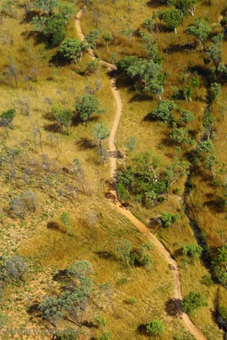
Off on a road trip now, just outside of Kununurra…

Highway Outcrop 2AM-003088. © 2014 Andrew McInnes.

Highway Outcrop 2AM-003079-003082 panorama © 2014 Andrew McInnes.

A couple of images of vehicles crossing a small creek on El Questro where we stopped off for a refreshing dip (swim).

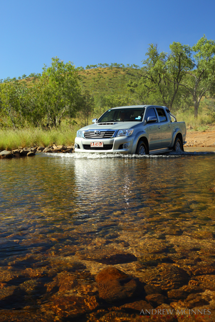
El Questro 2AM-003308. © 2014 Andrew McInnes.

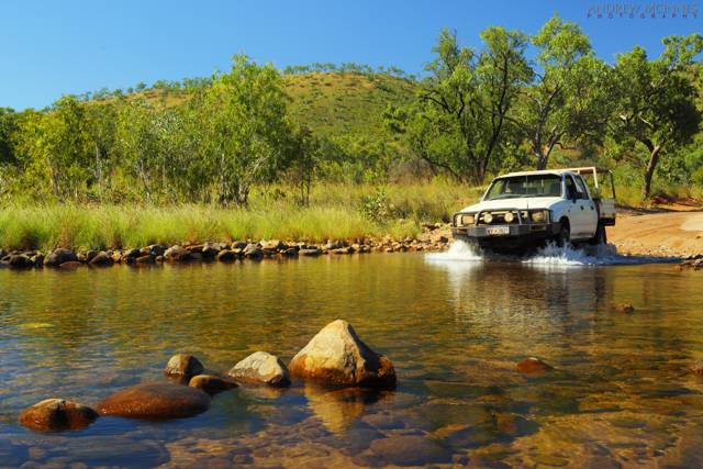
El Questro 2AM-003319. © 2014 Andrew McInnes.

Not far past El Questro, on the famed Gibb River Road, is the Cockburn Range which is adjacent to the iconic Pentecost River but the river was flowing too much for us to make a crossing. There was an unfortunate couple stranded during their attempt at crossing – their front axle fell into a deeply eroded hole resulting in a cracked oil-pan or something similar, necessitating a tow out of these croc-infested waters.

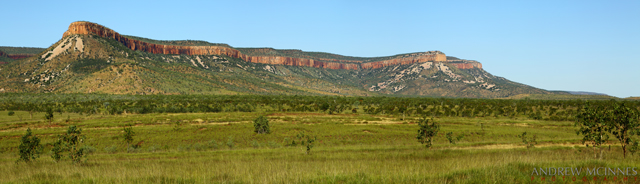
Cockburn Ranges 2AM-003366-003368 panorama. © 2014 Andrew McInnes.

Having captured this late-afternoon image of a man fishing for barramundi with a live bait on a hand line at the fast-flowing Ivanhoe Crossing, Kununurra, I moved on to shoot other nearby compositions. This area is accessible for the numerous salties of the Ord River and is also thick with barramundi. Soon after I moved I saw this fisherman in a mighty tug-of-war battle that, with the aid of the deep and rapidly flowing water, soon had him precariously close to taking an involuntary bath! Ultimately he was saved the ignominy as his large gauge hook was straightened, thus losing whatever was on the end of the line!
The Ivanhoe Crossing is no longer open to vehicles.

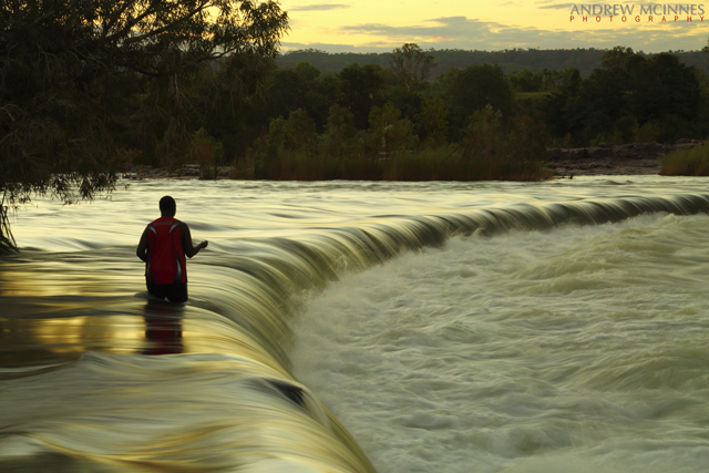
Ivanhoe Crossing 2AM-003178. © 2014 Andrew McInnes.


The next blog posting will contain images from Marlgu Billabong and Wyndham.
Until then, cheers.


Posting #9 of my road trip from Fremantle to Kununurra, Western Australia.

Other than the first two images, this post contains only aerial views of the Kununurra area, captured from a Robinson R22 helicopter owned and operated by Top End Mustering.

This is the helicopter for the trip, and the pilot – Ty Rankin (of Top End Mustering).

Helicopter-and-Pilot-2AM-003668

Helicopter and Pilot 2AM-003668. © 2014 Andrew McInnes.

Helicopter-2AM-003669

Helicopter 2AM-003669. © 2014 Andrew McInnes.

The Kimberley savannah and a portion of the lower Ord River – Ivanhoe Station.

Helicopter-and-Ord-River-2AM-003625

Helicopter-and-Ord-River-2AM-003625. © 2014 Andrew McInnes.

Below the dam of Lake Argyle, the Ord River Diversion Dam holds back Lake Kununurra, which gravity feeds the Ord River Irrigation Area with water via the Main Channel. The Victoria Highway crosses the river here.

Ord-River-Diversion-Dam-2AM-003654

Ord River Diversion Dam 2AM-003654. © 2014 Andrew McInnes.

Downstream of the Ord River Diversion Dam; the lowest reaches of Lake Kununurra meander to the upper left of the image, then beyond.

Ord-River-Diversion-Dam-2AM-003638

Ord River Diversion Dam 2AM-003638. © 2014 Andrew McInnes.

River flow below the Diversion Dam.

Ord-River-2AM-003616

Ord River 2AM-003616. © 2014 Andrew McInnes.

These next few images capture some of the irrigation ditches and the agriculture that depends on them.

Ord-River-Irrigation-Area-2AM-003541

Ord River Irrigation Area 2AM-003541. © 2014 Andrew McInnes.

Ord-River-Irrigation-Area-2AM-003567

Ord River Irrigation Area 2AM-003567. © 2014 Andrew McInnes.

Though a variety of crops are present (and others tried previously), these are Indian Sandalwood.

Ord-River-Irrigation-Area-2AM-003555

Ord River Irrigation Area 2AM-003555. © 2014 Andrew McInnes.

Ord-River-Irrigation-Area-2AM-003554

Ord River Irrigation Area 2AM-003554. © 2014 Andrew McInnes.

Great cattle stations abound in the Kimberley, and this savannah, like those throughout the world, look resplendent after the rains.

Kimberley-Savanna-2AM-003535

Kimberley Savanna 2AM-003535. © 2014 Andrew McInnes.

Kimberley-Savanna-2AM-003528

Kimberley Savanna 2AM-003528. © 2014 Andrew McInnes.

Kununurra-2AM-003604

Kununurra 2AM-003604. © 2014 Andrew McInnes.

A pair of graves on a station near Kununurra – DEACON, Thomas, died 28.6.1905 (age 49) & DURACK Neil Joseph, died 28.11.1920 (drowned, age 30).

Gravestones---Ivanhoe-Station-2AM-003608

Gravestones – Ivanhoe Station 2AM-003608. © 2014 Andrew McInnes.

Bordering the irrigation area are numerous ranges such as this.

Kununurra-2AM-003530

Kununurra 2AM-003530. © 2014 Andrew McInnes.

Edging and among the ranges there are numerous waterholes such as this, many with waterfalls (during/after the wet).

Kununurra-2AM-003597

Kununurra 2AM-003597. © 2014 Andrew McInnes.

Back to the immediate vicinity of Kununurra: This is “Sleeping Buddha”/Elephant Rock on the edge of Lake Kununurra.

Sleeping-Buddha-2AM-003512

Sleeping Buddha 2AM-003512. © 2014 Andrew McInnes.

Sleeping-Buddha-floodplain-2AM-003517

Sleeping Buddha floodplain 2AM-003517. © 2014 Andrew McInnes.

Two views of Lake Kununurra Golf Club – one of the hosts for famed the Ord Valley Muster.

Lake-Kununurra-Golf-Club-2AM-003662

Lake Kununurra Golf Club 2AM-003662. © 2014 Andrew McInnes.

Lake-Kununurra-Golf-Club-2AM-003664

Lake Kununurra Golf Club 2AM-003664. © 2014 Andrew McInnes.

The next post will feature Lake Kununurra – I hope you enjoyed this post.